Fort Ann in Washington County, New York — The American Northeast (Mid-Atlantic)
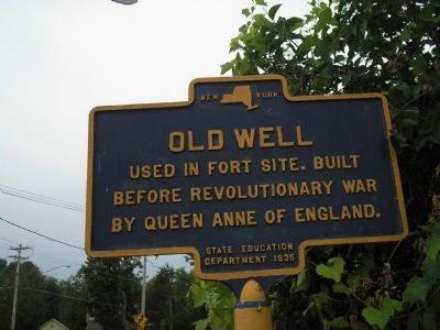
Old Well
Photographed by Bill Coughlin, July 13, 2008
1. Old Well Marker
before the Revolutionary War
by Queen Anne of England.
Erected 1935 by New York State Education Department.
Topics. This historical marker is listed in these topic lists: Colonial Era • Forts and Castles • Notable Places • War, US Revolutionary.
Location. 43° 24.998′ N, 73° 29.259′ W. Marker is in Fort Ann, New York, in Washington County. It is on Charles Street (County Road 16), on the right when traveling west. Touch for map. Marker is in this post office area: Fort Ann NY 12827, United States of America. Touch for directions.

Regionally, this marker is in Upstate New York and in the Capital District. It is also in the American Northeast and in the Mid-Atlantic. Globally, it is in North America, the Great North Woods, the Western Hemisphere, the Western World, and the Anglosphere. Historically, it finds itself in what was once the Viceroyalty of New France, New Netherland, and one of the original Thirteen Colonies.
Other nearby markers. At least 8 other markers are within walking distance of this marker: Fort Anne
this page online
Also see . . . The Battle of Fort Anne. The American Revolutionary War website. (Submitted on July 18, 2008, by Bill Coughlin of Woodland Park, New Jersey.)
Photographed by Bill Coughlin, July 13, 2008
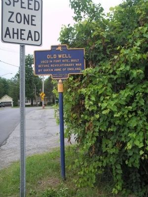
2. Marker in Fort Anne
Fort Anne was a fortification built in the wilderness in 1757, at the junction of Halfway Creek and Wood Creek. A battle was fought here on July 8, 1777 between Americans and a group of British under Gen. John Burgoyne.
Credits. This page was last revised on March 10, 2022. It was originally submitted on July 18, 2008, by Bill Coughlin of Woodland Park, New Jersey. This page has been viewed 1,793 times since then and 53 times this year. Last updated on August 5, 2012, by Tom McGreevy of Averill Park, New York. Photos: 1, 2. submitted on July 18, 2008, by Bill Coughlin of Woodland Park, New Jersey. • Kevin W. was the editor who published this page.
