Near Shingletown in Shasta County, California — The American West (Pacific Coastal)
A Night to Remember / Three Days Later
— Devastated Area —
Photographed By Barry Swackhamer, July 12, 2012
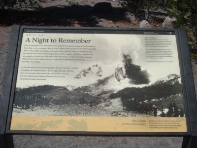
1. Devastated Area Marker - A Night to Remember
[Photo credit, bottom right]
B.F. Loomis, eyewitness and photographer
This photo of the Devastated Area was taken by B.F. Loomis just a few days after the May 19th volcanic destruction and just a few hours before Lassen Peak’s greatest eruption, May 22, 1915.
B.F. Loomis, eyewitness and photographer
This photo of the Devastated Area was taken by B.F. Loomis just a few days after the May 19th volcanic destruction and just a few hours before Lassen Peak’s greatest eruption, May 22, 1915.
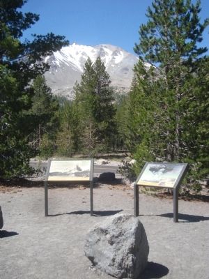
[Two markers, side-by-side, describe the events that created the Devastated Area.]
Marker 1:
You are standing in the aftermath of the volcanic destruction known as the Devastated Area. Late on the evening of May 19, 1915, a large steam explosion shattered the lava that filled Lassen Peak’s crater the previous days. Glowing blocks of hot lava fell on the summit and snow-covered upper flanks of the volcano. The impact touched off an avalanche of snow and lava rocks a half-mile wide. It roared down the volcano’s flank in front of you and continued up and over Emigrant Pass behind you.
As the lava blocks broke into fragments, the snow melted, creating a mudflow and volcanic debris, called a lahar. Though with less force, the torrent rushed down the path of the avalanche and was deflected by Emigrant Pass into Lost Creek, sweeping through homesteads.
In the night his dog barked, raved and stuck his paws against him...to wake him up. Elmer thought it might be...a bear or panther, so he got up...He..,peeped out to see what the dog was barking at. He saw the mud flow coming like a wave about twelve feet high....
From Wid Hall’s account of the May 19, 1915, mudflow
Marker 2:
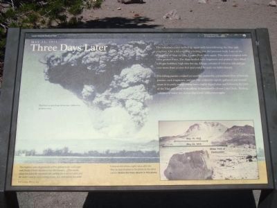
The volcano’s crater welled up again with lava following the May 19th eruption. Like a lid covering a boiling pot, the pressure built. This time it erupted with even greater force. The blast hurled rock fragments and pumice (lava filled with gas bubbles) high into the air. A huge column of volcanic ash and gas rose more than 30,000 feet and could be seen 150 miles distant.
The falling pumice created yet another avalanche, a pyroclastic flow of hot ash, pumice, rock fragments, and gas. The avalanche rapidly gathered and melted snow in its path, transforming into a highly liquid lahar and following the path of the May 19th lahar or mudflow. It rushed miles down Lost Creek, flushing volumes of water into lower Hat Creek Valley once again.
Erected by Lassen Volcanic National Park, Department of the Interior, National Park Service.
Topics. This historical marker is listed in this topic list: Disasters. A significant historical date for this entry is May 19, 1915.
Location. 40° 30.915′ N, 121° 27.917′ W. Marker is
Photographed By Barry Swackhamer, July 12, 2012
2. Devastated Area Marker - Three Days Later
[Captions:]
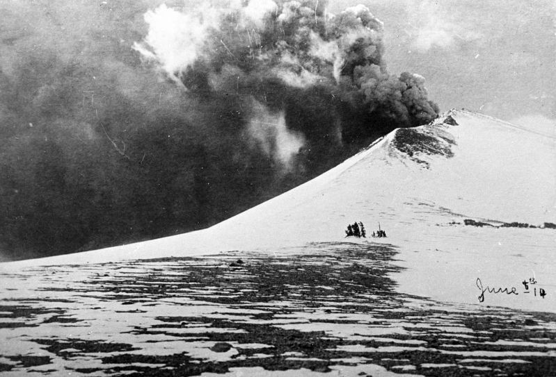
The blast as seen from Anderson, California, 50 miles away.
[Bottom Left]
The eruption came on gradually at first, getting larger and larger until finally it broke out into a roar like thunder.... [T]he smoke cloud ran down the mountain side, melting the snow very fast, and the water could be seen running down...in a rush twenty feet wide.
B.F. Loomis, May 22, 1915
Compare this photo (right) taken after the May 22, 1915 eruption to the photo on the other exhibit. Notice the trees absent in this photo.
Other nearby markers. At least 8 other markers are within 6 miles of this marker, measured as the crow flies. Hot Rock (approx. ¼ mile away); A Scenic Boulevard (approx. 3.4 miles away); Pluck and Carry (approx. 4.1 miles away); Bumpass’s Hell (approx. 4.4 miles away); Nobles' Emigrant Trail (approx. 4.6 miles away); Mt. Lassen/The Noble Pass/The Park Highway (approx. 4.6 miles away); Loomis Legacy (approx. 5.3 miles away); Stephen Tyng Mather (approx. 5.3 miles away). Touch for a list and map of all markers in Shingletown.
Also see . . . Eruptions of Lassen Peak, California, 1914 to 1917 - USGS. On May 22, 1915, an explosive eruption at Lassen Peak, California, the southernmost active volcano in the Cascade Range, devastated nearby areas and rained volcanic ash as far away as 200 miles to the east. (Submitted on August 6, 2012, by Barry Swackhamer of Brentwood, California.)
Additional keywords. volcanic eruption
Photographed By Barry Swackhamer, July 12, 2012
6. Devastated Area Trail Interpretive Sign
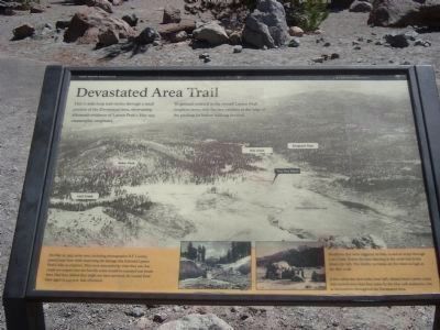
To ground yourself in the overall Lassen Peak eruption story, visit the two exhibits at the edge of the parking lot before walking the trail.
Lassen Volcanic National Park
[Photograph captions; bottom left, bottom right]
On May 22, 1915, seven men, including photographer B.F. Loomis passed near here while inspecting the damage that followed Lassen Peak’s May 19 eruption. The were astounded by what they saw, but could not suspect the horrific scene would be repeated just hours later. Had they dallied they might not have survived, for Lassen Peak blew again at 4:45 p.m. that afternoon.
Mudflows that were triggered on May 19 and 22 swept through Lost Creek. Notice the man standing in the creek bed in the photo (far left). The freshly cut banks are five times as high as the man is tall.
A few cabin-size lava rocks (near left), blasted from Lassen crater and carried more than four miles by the May 19th avalanche, rest as monuments throughout the Devastated Area.
[Click on the image to enlarge.]
Credits. This page was last revised on May 19, 2019. It was originally submitted on August 6, 2012, by Barry Swackhamer of Brentwood, California. This page has been viewed 998 times since then and 30 times this year. It was the Marker of the Week May 19, 2019. Photos: 1, 2, 3. submitted on August 6, 2012, by Barry Swackhamer of Brentwood, California. 4. submitted on May 18, 2019, by J. J. Prats of Powell, Ohio. 5, 6. submitted on August 6, 2012, by Barry Swackhamer of Brentwood, California. • Syd Whittle was the editor who published this page.
Editor’s want-list for this marker. Photos of the aftermath evidence seen on the trail. • Can you help?
