Westown in Milwaukee in Milwaukee County, Wisconsin — The American Midwest (Great Lakes)
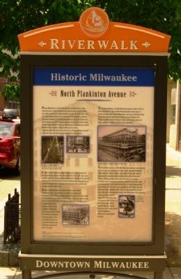
Historic Milwaukee
North Plankinton Avenue
Photographed by Paul Fehrenbach, June 8, 2012
1. Historic Milwaukee Marker
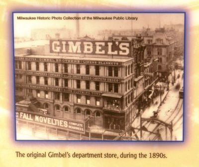
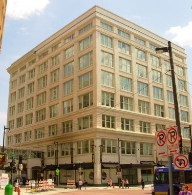
In 1887, the Gimbel family selected Milwaukee as the location for their flagship department store. They built their 30’ x 100’, four-story Gimbel’s store (they used an apostrophe then) at the site of its present building (101 West Wisconsin Avenue). Gimbel’s soon embarked on an expansion program that continued until the turn of the century and encompassed the entire block.
Know to Milwaukeeans for near 100 years as Gimbels Department Store, the building is an eight-story classicized Commercial Style building in white glazed brick and terra-cotta. Built in stages, the first part of the complex rose on Wisconsin Avenue from plans from the well-known Chicago firm of Daniel H. Burnham and Co. Alterations of the original structure, plus additions on Michigan Street, were made in 1919. The striking colonnaded riverfront section dates from 1923-25 and was reputedly modeled after Selfridges Department Store in London.
The Empire Building, 116 West Wisconsin Avenue, built in 1927, is one of Milwaukee’s most visible Roaring Twenties skyscrapers. It houses the Riverside Theater, Milwaukee’s last great vaudeville show house. The principal architectural feature of the building
this page online
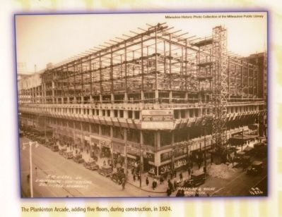
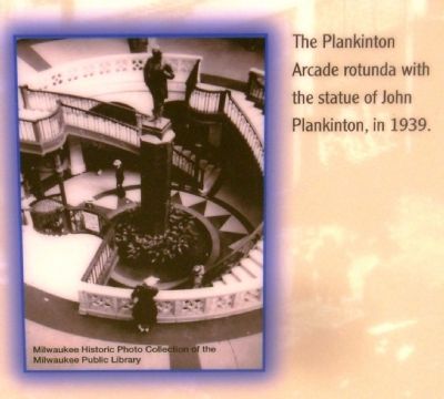
The Plankinton Arcade, at 161 West Wisconsin Avenue, was originally built as a two-story shopping arcade in 1915 and was enlarged in 1925 when five floors of offices were added. The arcade was the forerunner of today’s enclosed shopping mall with one structure housing numerous independent shops focused on an interior circulation area. It originally included a basement level with a first class dining salon, a 60-table billiard hall, a 41-lane bowling alley and a Turkish bath. The terra-cotta cladding of the original first two floors has Gothic detailing, while the later upper stories are clad in terra-cotta with a Renaissance motif. It was Milwaukee’s first shopping center, providing room for nearly 130 small shops. The centerpiece of the arcade is a spectacular skylit central rotunda with four circular staircases and a bronze statue of John Plankinton, Milwaukee’s meat packing magnate.
Topics. This historical marker is listed in these topic lists: Industry & Commerce • Settlements & Settlers. A significant historical year for this entry is 1835.
Location. 43° 2.336′ N,
Photographed by Paul Fehrenbach, June 8, 2012
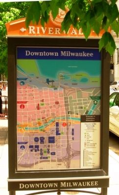
2. Historic Milwaukee Marker
Reverse side showing area map

Regionally, this marker is in Southeast Wisconsin. It is also in the American Midwest and in the Corn Belt. Globally, it is in North America, on the Great Lakes, in the Western Hemisphere, in the Western World, and in the Anglosphere. Historically, it finds itself in what was once the territory of the Mississippian Culture and also the Northwest Territory.
Other nearby markers. At least 8 other markers are within walking distance of this marker: Wisconsin Soldiers’ Home (within shouting distance of this marker); Milwaukee's Bridge War (about 300 feet away, measured in a direct line); Milwaukee's Miraculous Mallard (about 300 feet away); Gertie (about 400 feet away); The First House on the East Side of Milwaukee (about 500 feet away); Wisconsin's Oldest Newspaper (about 500 feet away); Nearly a Century of Planning (about 500 feet away); Architectural Gems on the Riverfront (about 500 feet away). Touch for a list and map of all markers in Milwaukee.
Photographed by Paul Fehrenbach, June 8, 2012
3. Historic Milwaukee Marker
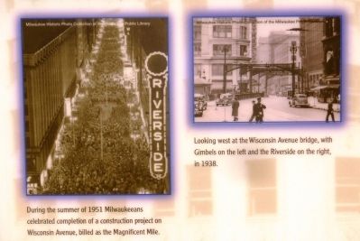
Photos Upper Left: Left – During the summer of 1951 Milwaukeeans celebrated completion of a construction project on Wisconsin Avenue, billed the Magnificent Mile.
Right – Looking west at the Wisconsin Avenue bridge, with Gimbels on the left and the Riverside on the right, in 1938.
Photos courtesy of the Milwaukee Historic Photo Collection of the Milwaukee Public Library
Photographed by Paul Fehrenbach, June 8, 2012
4. Historic Milwaukee Marker
Photo Lower Left: The original Gimbel’s department store, during the 1890s.
Photo courtesy of the Milwaukee Historic Photo Collection of the Milwaukee Public Library
Photographed by Paul Fehrenbach, June 8, 2012
5. Historic Milwaukee Marker
Photo Upper Right: The Plankinton Arcade, adding five floors, during construction, in 1924.
Photo courtesy of the Milwaukee Historic Photo Collection of the Milwaukee Public Library
Photographed by Paul Fehrenbach, June 8, 2012
6. Historic Milwaukee Marker
Photo Lower Right: The Plankinton Arcade rotunda with the statue of John Plankinton, in 1939.
Photo courtesy of the Milwaukee Historic Photo Collection of the Milwaukee Public Library
Photographed by Paul Fehrenbach, June 8, 2012
7. Gimbels Building today
Home of a Residence Inn, ASQ headquarters and other businesses.
Photographed by Paul Fehrenbach, August 10, 2012
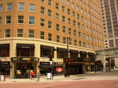
8. Riverside Theater today
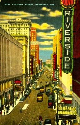
circa 1930
9. West Wisconsin Avenue, Milwaukee, Wis.
The Plankinton Arcade is on the left, and the Empire Building (The Riverside Theater, staging a "Gay Girly Revue" when this image was taken) on the right.
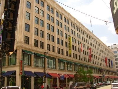
Photographed by Paul Fehrenbach, June 8, 2012
10. Plankinton Building today.
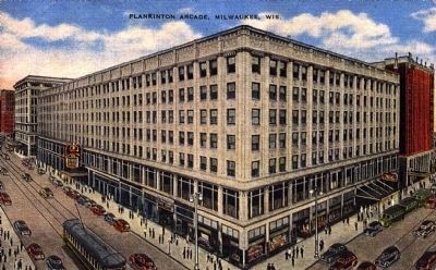
circa 1935
11. Plankinton Arcade, Milwaukee, Wis.
Credits. This page was last revised on February 16, 2023. It was originally submitted on August 8, 2012, by Paul Fehrenbach of Richfield, Wisconsin. This page has been viewed 1,572 times since then and 108 times this year. Photos: 1, 2, 3, 4, 5, 6, 7. submitted on August 8, 2012, by Paul Fehrenbach of Richfield, Wisconsin. 8. submitted on August 10, 2012, by Paul Fehrenbach of Richfield, Wisconsin. 9. submitted on November 16, 2014. 10. submitted on August 8, 2012, by Paul Fehrenbach of Richfield, Wisconsin. 11. submitted on November 16, 2014. • Bernard Fisher was the editor who published this page.
