East Greenwich in Kent County, Rhode Island — The American Northeast (New England)
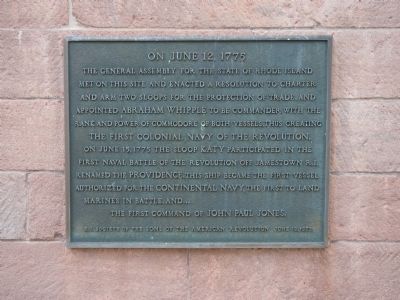
June 12, 1775
Erected 1975 by R.I. Society of the Sons of the American Revolution.
Topics and series. This historical marker is listed in these topic lists: Patriots & Patriotism • War, US Revolutionary • Waterways & Vessels. In addition, it is included in the Sons of the American Revolution (SAR) series list. A significant historical month for this entry is June 1839.
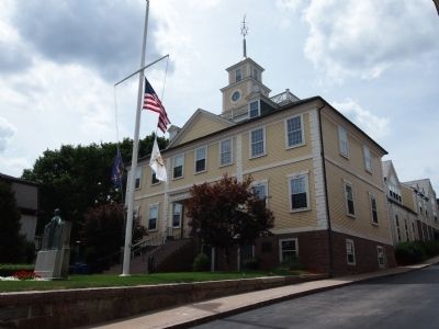
Location. 41° 39.732′ N, 71° 27.024′ W. Marker is in East Greenwich, Rhode Island, in Kent County. Marker is on Court House Lane, on the right when traveling east. Touch for map. Marker is in this post office area: East Greenwich RI 02818, United States of America. Touch for directions.
Other nearby markers. At least 8 other markers are within walking distance of this marker. General James Mitchell Varnum Home (within shouting distance of this marker); Armory of the Kentish Guards (about 400 feet away, measured in a direct line); Michaud Memorial (about 500 feet away); Varnum Continentals (about 600 feet away); Rhode Island State & National Guard Units (about 600 feet away); Varnum Memorial Armory (about 600 feet away); Kentish Guards Drill Field (about 700 feet away); The Marlborough Street Chapel (approx. 0.2 miles away). Touch for a list and map of all markers in East Greenwich.
Credits. This page was last revised on July 19, 2019. It was originally submitted on August 10, 2012, by Bryan Simmons of Attleboro, Massachusetts. This page has been viewed 969 times since then and 22 times this year. Photos: 1, 2. submitted on August 10, 2012, by Bryan Simmons of Attleboro, Massachusetts. 3. submitted on June 24, 2019, by Allen C. Browne of Silver Spring, Maryland. • Bill Pfingsten was the editor who published this page.


