Iphofen in Kitzingen, Bavaria, Germany — Central Europe
Mainbernheimer Gate
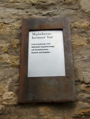
Mainbernheimer Tor
Photographed by Andrew Ruppenstein, July 14, 2012
1. Mainbernheimer Gate Marker

Erste Erwähnung 1422.
Wehrhafte Doppeltoranlage
mit Torwächterhaus,
Vorwerk und Haupttor.
First mentioned in 1422. Fortified double-gate structure with gatekeeper's house, forward works, and main gate.
Topics. This historical marker is listed in this topic list: Forts and Castles. A significant historical year for this entry is 1422.
Location. 49° 42.175′ N, 10° 15.45′ E. Marker is in Iphofen, Bayern (Bavaria), in Kitzingen. It is at the intersection of Mainbernheimerstrasse and Am Stadtgraben West, on the right when traveling east on Mainbernheimerstrasse. Touch for map. Marker is in this post office area: Iphofen BY 97346, Germany. Touch for directions.

Regionally, this marker is in German Franconia. Globally, it is in Europe, the European Union, Atlantic Europe, Central Europe, the Schengen Area, Western Europe, and the Western World. Historically, it finds itself in what was once the Holy Roman Empire and also the former West Germany.
Other nearby markers. At least 8 other markers are within 8 kilometers of this
this page online
Also see . . . An interactive 360-degree panoramic view of the Mainbernheimer Gate. (Submitted on August 13, 2012.)
Photographed by Andrew Ruppenstein, July 14, 2012
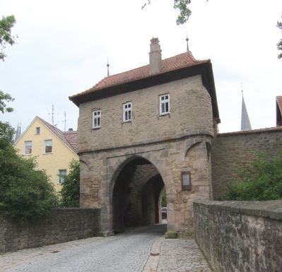
2. Mainbernheimer Gatehouse and marker - western side
The marker is clearly visible here, mounted head-high on the wall just to the right of the entryway.
Photographed by Andrew Ruppenstein, July 14, 2012
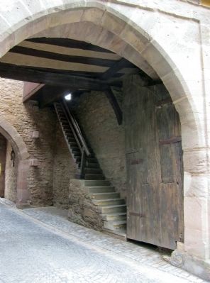
3. Mainbernheimer Gatehouse interior- stairs to upper level

Photographed by Unknown, circa 1920
4. Mainbernheimer Gate and Bürgerspital - postcard view
This postcard view shows the outer part of the gate, with the gatekeeper's home on the left part of the gate. The main gatehouse (shown in picture 2), is partially visible here through the gate. The Bürgerspital is the building in the background on the left. (A Bürgerspital is a sort of home for the indigent or sick.)
Credits. This page was last revised on January 7, 2024. It was originally submitted on August 13, 2012, by Andrew Ruppenstein of Lamorinda, California. This page has been viewed 558 times since then and 8 times this year. Photos: 1, 2, 3, 4. submitted on August 13, 2012, by Andrew Ruppenstein of Lamorinda, California. • Bill Pfingsten was the editor who published this page.
