East Greenwich in Kent County, Rhode Island — The American Northeast (New England)
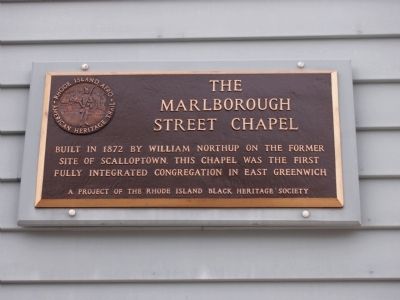
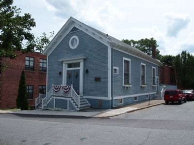
The Marlborough Street Chapel
Rhode Island Afro-American Heritage Trail
Erected by Rhode Island Black Heritage Society.
Topics and series. This historical marker is listed in these topic lists: Abolition & Underground RR • African Americans • Churches & Religion • Settlements & Settlers. In addition, it is included in the The Rhode Island Black Heritage Society series list. A significant historical year for this entry is 1872.
Location. 41° 39.59′ N, 71° 26.934′ W. Marker is in East Greenwich, Rhode Island, in Kent County. Marker is at the intersection of Marlborough Street and Long Street, on the left when traveling south on Marlborough Street. Touch for map. Marker is at or near this postal address: 27 Long St, East Greenwich RI 02818, United States of America. Touch for directions.
Other nearby markers. At least 8 other markers are within walking distance of this marker. Michaud Memorial (about 700 feet away, measured in a direct line); Armory of the Kentish Guards (about 700 feet away); June 12, 1775 (approx. 0.2 miles away); General James Mitchell Varnum Home (approx. 0.2 miles away); Kentish Guards Drill Field (approx. 0.2 miles away); Varnum Continentals (approx. ¼ mile away); Rhode Island State & National Guard Units (approx. 0.3 miles away); Varnum Memorial Armory (approx. 0.3 miles away). Touch for a list and map of all markers in East Greenwich.
Credits. This page was last revised on May 10, 2023. It was originally submitted on August 8, 2012, by Bryan Simmons of Attleboro, Massachusetts. This page has been viewed 861 times since then and 40 times this year. Last updated on August 13, 2012, by Bryan Simmons of Attleboro, Massachusetts. Photos: 1, 2. submitted on August 8, 2012, by Bryan Simmons of Attleboro, Massachusetts. • Kevin W. was the editor who published this page.

