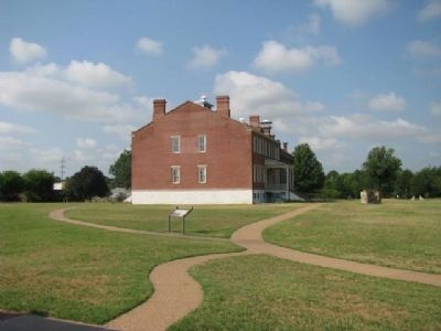
Fort Smith in Sebastian County, Arkansas — The American South (West South Central)
The Flagstaff
Fort Smith National Historic Site
— National Park Service, U.S. Department of the Interior —
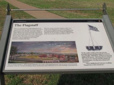
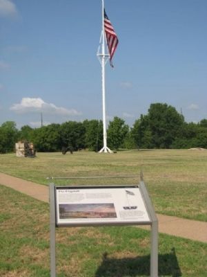
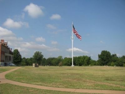
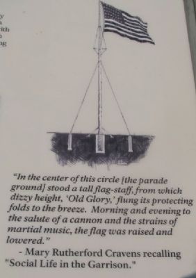
When the army closed Fort Smith in 1871, they removed the flagstaff. The “Old Fort Militia,” a local citizen support group, in cooperation with the National Park Service rebuilt the flagstaff in 1984-85. Its 37-star flag is a replica of the last flag flown here by the army, from 1867-1871.
Erected by National Park Service, U.S. Department of the Interior.
Topics. This historical marker is listed in this topic list: Military. A significant historical year for this entry is 1846.
Location. 35° 23.329′ N, 94° 25.764′ W. Marker is in Fort Smith, Arkansas, in Sebastian County. Marker is on Parker Avenue, on the left when traveling north. Located in Fort Smith National Historic Site National Park. Touch for map. Marker is at or near this postal address: 301 Parker Avenue, Fort Smith AR 72901, United States of America. Touch for directions.
Other nearby markers. At least 8 other markers are within walking distance of this marker. The Women’s Jail, 1872-1888 (a few steps from this marker); The Guardhouse, 1849-1871 (within shouting distance of this marker); The Parade Grounds (within shouting distance of this marker); Old Federal Building (within shouting distance of this marker); The Bastion That Never Was (within shouting distance of this marker); Meeting of Nations (within shouting distance of this marker); Clues from the Past (within shouting distance of this marker); Deputy U.S. Marshal Bass Reeves (within shouting distance of this marker). Touch for a list and map of all markers in Fort Smith.
Photographed By Denise Boose, July 13, 2012
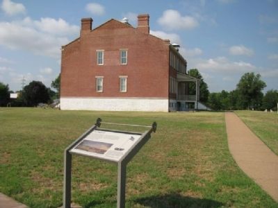
3. The Flagstaff Marker
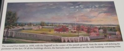
The second Fort Smith ca. 1850, with the flagstaff in the center of the parade ground. Note the stone wall defining the perimeter of the fort. Of all the buildings shown, the barracks and commissary are the only buildings remaining today.
Photographed By Denise Boose, July 13, 2012
4. The Flagstaff Marker
“In the center of this circle [the parade ground] stood a tall flag-staff, from which dizzy height, ‘Old Glory,’ flung its protecting folds to the breeze. Morning and evening to the salute of a cannon and the strains of martial music, the flag was raised and lowered.” -Mary Rutherford Cravens recalling “Social Life in the Garrison.”
Credits. This page was last revised on June 12, 2020. It was originally submitted on August 14, 2012, by Denise Boose of Tehachapi, California. This page has been viewed 879 times since then and 13 times this year. Photos: 1, 2, 3, 4, 5, 6, 7. submitted on August 14, 2012, by Denise Boose of Tehachapi, California. • Craig Swain was the editor who published this page.
