Fort Smith in Sebastian County, Arkansas — The American South (West South Central)
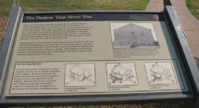
The Bastion That Never Was
Fort Smith National Historic Site
— National Park Service, U.S. Department of the Interior —
Quartermaster General Thomas Jesup inspected Fort Smith in 1845 and ordered this fortification converted into a commissary depot. General Jesup’s intervention led to Fort Smith’s continued growth by shifting the mission of the post from defense to supply. With supply as its primary mission, Fort Smith became one of the largest and busiest posts in the southwest prior to the Civil War.
Erected by National Park Service, U.S. Department of the Interior.
Topics. This historical marker is listed in these topic lists: Forts and Castles • Military. A significant historical month for this entry is March 1839.
Location. 35° 23.342′ N, 94° 25.792′ W. Marker is in Fort Smith, Arkansas, in Sebastian County. Marker is on Parker Avenue , on the left when traveling north. Located within Fort Smith National Historic Site National Park. Touch for map. Marker is at or near this postal address: 301 Parker Avenue, Fort Smith AR 72901, United States of America. Touch for directions.
Other nearby markers. At least 8 other markers are within walking distance of this marker. Officer’s Garden (within shouting distance of this marker); The Parade Grounds (within shouting distance of this marker); The Guardhouse, 1849-1871 (within shouting distance of this marker); Old Commissary (within shouting distance of this marker); Old Federal Building (within shouting distance of this marker); The Flagstaff (within shouting distance of this marker); The Women’s Jail, 1872-1888 (within shouting distance of this marker); A Building Worth Saving (within shouting distance of this marker). Touch for a list and map of all markers in Fort Smith.

Photographed By Denise Boose, July 13, 2012
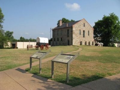
3. The Bastion That Never Was Marker
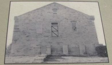
The lower section of the walls show the reinforced nature of the bastions. Up to five feet thick, these wall sections were the only part of the defensive structure ever completed. The upper walls of the commissary were built on top of the existing bastion walls.

Photographed By Denise Boose, July 13, 2012
4. An Evolving Exterior
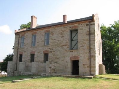
As the function of the commissary building changed over time, so too did the appearance of the building. Windows and doors were added and removed, and porches changed to provide access to the upper level of the building. National Park Service staff have used written records and archeological evidence to determine the arrangement of the porches and doorways at different times.
Credits. This page was last revised on June 12, 2020. It was originally submitted on August 14, 2012, by Denise Boose of Tehachapi, California. This page has been viewed 674 times since then and 15 times this year. Photos: 1, 2, 3, 4, 5, 6. submitted on August 14, 2012, by Denise Boose of Tehachapi, California. • Craig Swain was the editor who published this page.


