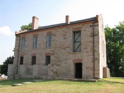
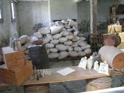
Fort Smith in Sebastian County, Arkansas — The American South (West South Central)
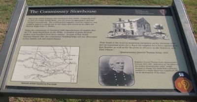
The Commissary Storehouse
Fort Smith National Historic Site
— National Park Service, U.S. Department of the Interior —
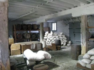
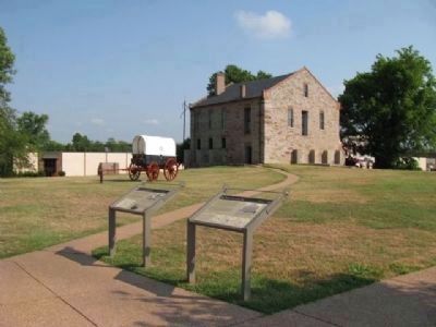
Today the commissary is furnished with reproductions of supplies that the U.S. Army stored here in the 1850s. A number of posts located farther west benefited from these rations. As part of Fort Smith National Historic Site, the commissary building helps tell one dimension of Fort Smith’s rich and varied history
Erected by National Park Service, U.S. Department of the Interior.
Topics. This historical marker is listed in this topic list: Military.
Location. 35° 23.257′ N, 94° 25.745′ W. Marker is in Fort Smith, Arkansas, in Sebastian County. Marker is on Parker Avenue, on the left when traveling north. With the Fort Smith National Historic Site National Park. Touch for map. Marker is at or near this postal address: 301 Parker Avenue, Fort Smith AR 72901, United States of America. Touch for directions.
Other nearby markers. At least 8 other markers are within walking distance of this marker. Confederate [and] Union Occupation of Fort Smith (within shouting distance of this marker); Welcome to Fort Smith (within shouting distance of this marker); First Butterfield Overland Mail Coach (within shouting distance of this marker); Barracks, Courthouse, Jail (within shouting distance of this marker); Clues from the Past (about 300 feet away, measured in a direct line); The Gallows (about 300 feet away); Executions at Fort Smith (about 300 feet away); Confederates Occupy The Fort (about 400 feet away). Touch for a list and map of all markers in Fort Smith.
Photographed By Denise Boose, July 13, 2012
2. The Commissary Storehouse Marker
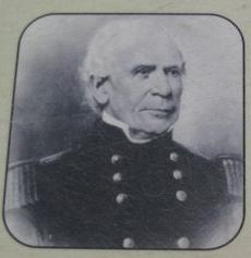
Brigadier General Thomas Jesup, Quartermaster General, 1816-1860. Referred to as "the father of the modern Quartermaster corps," Jesup's decision to change Fort Smith from a defensive position to a supply depot had a significant effect on the development of the region.
Photographed By Denise Boose, July 13, 2012
5. The Commissary Storehouse Marker
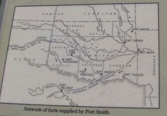
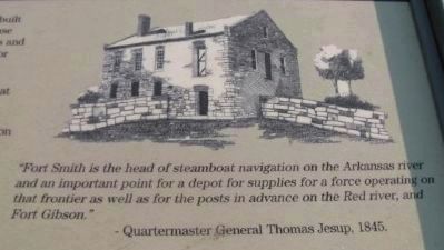
“Fort Smith is the head of steamboat navigation on the Arkansas river and an important point for a depot for supplies for a force operating on that frontier as well as for the posts in advance on the Red river, and Fort Gibson.” –Quartermaster General Thomas Jesup, 1845.
Credits. This page was last revised on June 12, 2020. It was originally submitted on August 17, 2012, by Denise Boose of Tehachapi, California. This page has been viewed 602 times since then and 15 times this year. Photos: 1, 2, 3, 4, 5, 6, 7, 8. submitted on August 17, 2012, by Denise Boose of Tehachapi, California. • Craig Swain was the editor who published this page.
