Near Berkeley Springs in Morgan County, West Virginia — The American South (Appalachia)
Camp Mud
Unger's Crossroads Bivouacs
— Jackson's Bath-Romney Campaign —
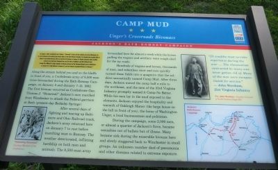
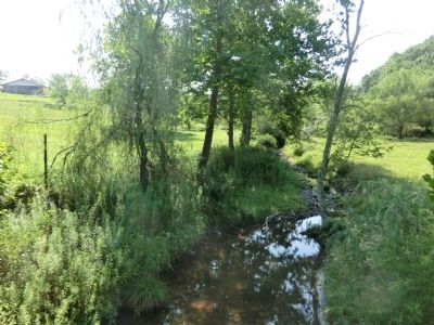
Along the stream behind you and on the bluffs in front of you, a Confederate army of 8,500 men twice bivouacked during the Bath-Romney Campaign, on January 2 and January 7-13, 1862. The first bivouac occurred as Confederate Gen. Thomas J. “Stonewall” Jackson’s men marched from Winchester to attack the Federal garrison at Bath (present day Berkeley Springs).
After several days of fighting and tearing up Baltimore and Ohio Railroad track, Jackson’s army returned here on January 7 to rest before marching west to Romney. The weather deteriorated, inflicting hardship on both men and animals. The 8,500-man army bivouacked here for almost a week while the horses pulling the wagons and artillery were rough-shod for the icy roads.
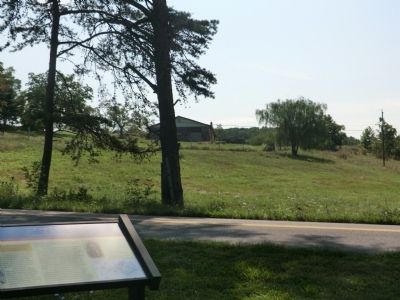
Hundreds of wagons and horses, thousands of men, and relentless snow and rain quickly turned these fields into a quagmire that the soldiers sarcastically named Camp Mud. After three days, Jackson moved the camp half a mile to the northeast, and the men of the 33rd Virginia Infantry promptly named it Camp No Better. While his men lay in the mud exposed to the elements, Jackson enjoyed the hospitality and warmth of Oakleigh Manor (the large house on the hill in front of you), the home of Washington Unger, a local businessman and politician.
During the campaign, some 2,000 men, or almost a quarter of Jackson’s force, became casualties not of bullets but illness. Many became sick during the miserable bivouac here and slowly staggered back to Winchester in small groups. An unknown number died of pneumonia and other diseases related to extreme exposure.
Erected by West Virginia Civil War Trails.
Topics and series. This historical marker is listed in this topic list: War, US Civil. In addition, it is included in the West Virginia Civil War Trails series list. A significant historical month for this entry is January 1862.
Location. 39° 26.166′ N, 78° 15.288′ W. Marker is near Berkeley Springs, West Virginia, in Morgan County. Marker is at the intersection of Ungers Store Road and Winchester Grade Road (County Route 13) on Ungers Store Road. Touch for map. Marker is at or near this postal address: 199 County Rte 13, Berkeley Springs WV 25411, United States of America. Touch for directions.
Other nearby markers. At least 8 other markers are within 6 miles of this marker, measured as the crow flies. West Virginia (Morgan County) / Virginia (approx. 2.9 miles away); Ridge Fish Hatchery (approx. 3.6 miles away); Welcome to Cacapon State Park (approx. 4.9 miles away); Cacapon State Park Playground Equipment (approx. 5 miles away); Cacapon State Park Picnic Grills (approx. 5.1 miles away); Cacapon State Park (approx. 5.1 miles away); Oriskany Sand (approx. 5.2 miles away); Cacapon Mountain Overlook (approx. 5.3 miles away). Touch for a list and map of all markers in Berkeley Springs.
Credits. This page was last revised on July 14, 2022. It was originally submitted on August 22, 2012. This page has been viewed 1,837 times since then and 72 times this year. Last updated on November 5, 2020, by Bradley Owen of Morgantown, West Virginia. Photos: 1. submitted on August 22, 2012, by Don Morfe of Baltimore, Maryland. 2, 3. submitted on August 28, 2012, by Don Morfe of Baltimore, Maryland. • J. Makali Bruton was the editor who published this page.
Editor’s want-list for this marker. A context photo showing the entire marker • Can you help?


