Bantam in Litchfield in Northwest Hills Region, Connecticut — The American Northeast (New England)
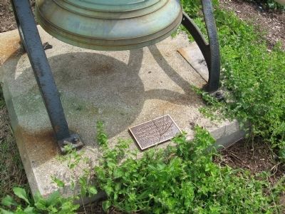
Site of Methodist Church

Photographed by Michael Herrick, August 20, 2012
1. Site of Methodist Church Marker
The Methodist Church
Which Was Destroyed
By The Tornado Of
July 10, 1989
Topics. This historical marker is listed in these topic lists: Disasters • Religion & Religious Structures. A significant historical month for this entry is July 1953.
Location. 41° 43.421′ N, 73° 14.367′ W. Marker is in Litchfield in Northwest Hills Region, Connecticut. It is in Bantam. It is at the intersection of Bantam Road (U.S. 202) and Vanderpoel Avenue, on the right when traveling west on Bantam Road. Touch for map. Marker is at or near this postal address: 866 Bantam Rd, Bantam CT 06750, United States of America. Touch for directions.

Regionally, this marker is in the Berkshire Foothills and in the Litchfield Hills. It is also in the American Northeast and in New England. Globally, it is in North America, the Western Hemisphere, the Western World, and the Anglosphere. Historically, it finds itself in what was once Litchfield County and also one of the original Thirteen Colonies.
Other nearby markers. At least 8 other markers are within 3 miles of this marker, measured as the crow flies: Dedicated To All Veterans
this page online
Photographed by Michael Herrick, August 20, 2012
2. Site of Methodist Church Marker

Photographed by Michael Herrick, August 20, 2012
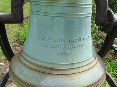
3. The bell is all that is left from the Bantam Methodist Church
Photographed by Michael Herrick, August 20, 2012
4. Inscription on the Bell
Baltimore, MD
1885

Photographed by Michael Herrick, August 20, 2012
5. The Methodist Church Bell
Credits. This page was last revised on May 19, 2026. It was originally submitted on August 22, 2012, by Michael Herrick of Southbury, Connecticut. This page has been viewed 805 times since then and 36 times this year. Photos: 1, 2, 3, 4, 5. submitted on August 22, 2012, by Michael Herrick of Southbury, Connecticut.
