Gore in Hampshire County, West Virginia — The American South (Appalachia)
The Guns Of Jacob Sheetz
Hunting of a Different Sort
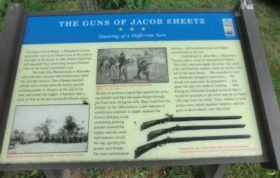
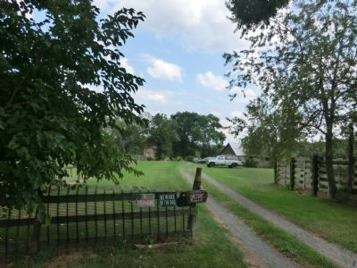
The shop of Jacob Sheetz, a Hampshire County gunsmith, once stood ahead of you in the yard to the right of the house. In 1861, Sheetz found himself unusually busy converting ancient flintlock rifles to the modern percussion type.
The long rifle (Pennsylvania or Kentucky rifle) had been popular with frontiersmen since the mid-18th century. The rifleman rammed powder and a bullet down the barrel, poured priming powder in the pan on the side of the lock, and pulled the trigger. A hammer with a piece of flint in its jaws struck the frizzen above the pan to produce a spark that ignited the priming powder and then the main charge through the flash hole, firing the rifle. Rain could foul the powder; in the 19th century, a new waterproof system was invented. A nipple replaced the frizzen and pan, a cap containing priming powder covered the nipple, and the modified hammer struck the cap, igniting the primer and charge. The next technological advance---self-contained metal cartridges---arrived later in the war.
Confederate Lt. John Blue, a Hampshire County native, wrote of visiting Jacob Sheetz. “Our arms were principally the home rifle {and} a few old flintlock muskets which we found in the loft of the court house….We concluded to have our flintlocks changed to percussion….We moved our camp near the gunsmith’s…. and spent the next two weeks in hunting….After having our flintlocks changed we found that it would be necessary to get army caps as our home rifle caps were too small.” Soon, soldiers in both armies were issued standard weapons, and the guns of Jacob Sheetz were discarded.
Erected by West Virginia Civil War Trails.
Topics and series. This historical marker is listed in this topic list: War, US Civil. In addition, it is included in the West Virginia Civil War Trails series list. A significant historical year for this entry is 1861.
Location. 39° 22.998′ N, 78° 39.864′ W. Marker is in Gore, West Virginia, in Hampshire County. Marker is on Old Jersey Mountain Road, on the right when traveling north. Touch for map. Marker is at or near this postal address: 2514 Old Jersey Mountain Road, Romney WV 26757, United States of America. Touch for directions.
Other nearby markers. At least 8 other markers are within 6 miles of this marker, measured as the crow flies. Mount Bethel Church (approx. 1.4 miles away); Fort Forman (approx. 4 miles away); Wire Bridge Engagement (approx. 4 miles away); Old District Parsonage (approx. 5˝ miles away); W. Va School for the Deaf and Blind (approx. 5.6 miles away); Romney In The Civil War (approx. 5.6 miles away); Town of Romney (approx. 5.6 miles away); Grapeshot Among the Pines (approx. 5.6 miles away).
Credits. This page was last revised on June 11, 2022. It was originally submitted on August 22, 2012, by Don Morfe of Baltimore, Maryland. This page has been viewed 1,340 times since then and 56 times this year. Photos: 1, 2. submitted on August 22, 2012, by Don Morfe of Baltimore, Maryland. • Craig Swain was the editor who published this page.

