Hermann in Gasconade County, Missouri — The American Midwest (Upper Plains)
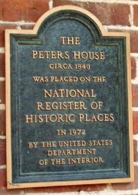
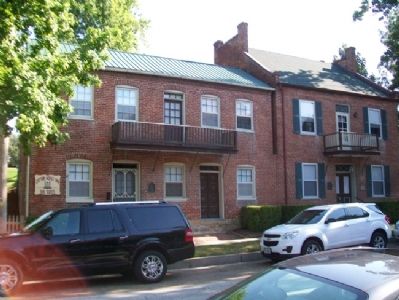
The Peters House
Circa 1840
National Register of
Historic Places
in 1972 by the
United States
Department of the Interior
Topics. This historical marker is listed in these topic lists: Architecture • Settlements & Settlers. A significant historical year for this entry is 1972.
Location. 38° 42.314′ N, 91° 26.194′ W. Marker is in Hermann, Missouri, in Gasconade County. Marker is on 3rd Street near Schiller Street, on the left when traveling east. Touch for map. Marker is at or near this postal address: 123 East 3rd Street, Hermann MO 65041, United States of America. Touch for directions.
Other nearby markers. At least 8 other markers are within walking distance of this marker. The Poeschel House (a few steps from this marker); Siedler's Building (a few steps from this marker); 113 East 3rd Street (within shouting distance of this marker); 109 East 3rd Street (within shouting distance of this marker); Drusch-Koeller Building (about 300 feet away, measured in a direct line); Operation Allen Brook Memorial (about 300 feet away); The Robyn House (about 300 feet away); Veterans Memorial (about 300 feet away). Touch for a list and map of all markers in Hermann.
Also see . . .
1. Captain Wohlt Inn. (Submitted on August 23, 2012, by William Fischer, Jr. of Scranton, Pennsylvania.)
2. Hermann Historic District NRHP, Missouri (1972) . (Submitted on August 23, 2012, by William Fischer, Jr. of Scranton, Pennsylvania.)
Credits. This page was last revised on May 1, 2022. It was originally submitted on August 23, 2012, by William Fischer, Jr. of Scranton, Pennsylvania. This page has been viewed 382 times since then and 10 times this year. Photos: 1, 2. submitted on August 23, 2012, by William Fischer, Jr. of Scranton, Pennsylvania.

