Hattiesburg in Forrest County, Mississippi — The American South (East South Central)
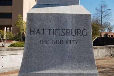
Hattiesburg
The Hub City
— Centennial of Hattiesburg —
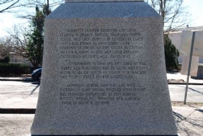
[West Side]
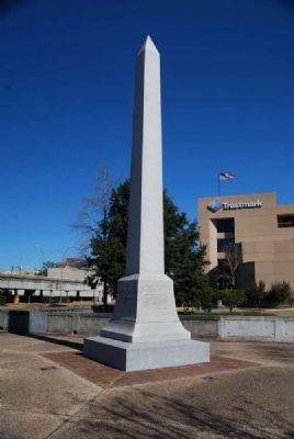
Formerly Choctaw Territory and later claimed by France, Britain, Spain and United States, this area entered by settlers in early 1800s and known as Ewin Forks, later Gordonville. Chosen as rail center by Captain William H. Hardy in 1880 and later renamed Hattiesburg after his wife, Hattie Lott.
Incorporated in 1884, the city grew as rail, timber and mercantile hub of south Mississippi, becoming major center of yellow pine industry and by 1911, state's fourth largest city.
Important during both WWI and WWII as location of Camp Shelby, postwar development has enhanced Hattiesburg as educational, medical, mercantile, financial and cultural center of south Mississippi.
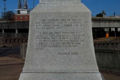
[East Side]
"...I was returning from the trip and had reached the banks of a beautiful piney woods stream...during July or perhaps August 1882.
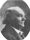
"...I then and there determined to locate a station here because it was the place where the line from the Gulf Coast would cross the New Orleans and Northeastern. I also decided to name the place Hattiesburg for my wife Hattie." -- William H. Hardy
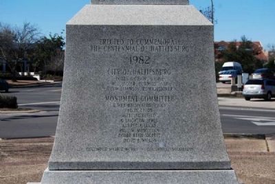
[North Side]
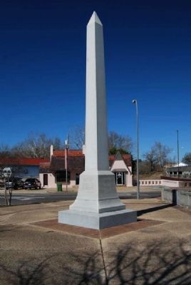
The Centennial of Hattiesburg
1982
City of Hattiesburg
Bobby L. Chain, Mayor
W.U. Sigler, Commissioner
G.D. Williamson, Commissioner
Monument Committee R. Web Heidelberg, Chmn.
Alvin Faton
Wiley Fairchild
G. Leighton Lewis
Aubrey K. Lucas
Paul W. McMullan
Bobby Reed Sigrest
David B. Wilson
Columbus Marble Works • Columbus, Mississippi
Erected 1982.
Topics. This historical marker is listed in this topic list: Settlements & Settlers. A significant historical year for this entry is 1880.
Location. 31° 19.483′ N, 89° 17.55′ W. Marker is in Hattiesburg, Mississippi, in Forrest County. Marker is at the intersection of Hardy Street and East Pine Street (U.S. 11), in the median on Hardy Street. Touch for map. Marker is in this post office area: Hattiesburg MS 39401, United States of America. Touch for directions.
Other nearby markers. At least 10 other markers are within walking distance of this marker. William Harris Hardy (about 500 feet away, measured in a direct line); Old Federal Building (about 600 feet away); a different marker also named William Harris Hardy (about 700 feet away); Forrest County Confederate Monument (approx. 0.2 miles away); McLeod House (approx. ¼ mile away); Veterans of All Wars Monument (approx. 0.3 miles away); Pittman Park (approx. 0.3 miles away); Old Hattiesburg High School (approx. 0.4 miles away); St. Paul Methodist Church (approx. 0.6 miles away); J.B. Woods Park (approx. 0.6 miles away). Touch for a list and map of all markers in Hattiesburg.
Also see . . .
1. City of Hattiesburg. With a population of nearly 50,000 and the fourth largest city in the state, Hattiesburg is centrally located less than 90 minutes from New Orleans and Mobile, the Gulf Coast and Jackson, Mississippi. (Submitted on August 28, 2012, by Brian Scott of Anderson, South Carolina.)
2. Hattiesburg, Mississippi. Hattiesburg is a city in Mississippi, bisected between Forrest County (where it is the county seat) and Lamar County. (Submitted on August 28, 2012, by Brian Scott of Anderson, South Carolina.)
3. William H. Hardy. William H. Hardy (1837—1917) founded the cities of Hattiesburg and Laurel, Mississippi, and co-founded the city of Gulfport, Mississippi. (Submitted on August 28, 2012, by Brian Scott of Anderson, South Carolina.)
Credits. This page was last revised on June 16, 2016. It was originally submitted on August 28, 2012, by Brian Scott of Anderson, South Carolina. This page has been viewed 761 times since then and 22 times this year. Photos: 1, 2, 3, 4, 5, 6, 7. submitted on August 28, 2012, by Brian Scott of Anderson, South Carolina.
