La Habra in Orange County, California — The American West (Pacific Coastal)
West Coyote Field, The La Habra Research Laboratory
Inscription.
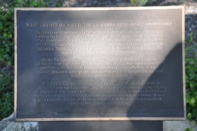
This site is on the northern edge of the West Coyote oil field, one of the largest fields in the Los Angeles Basin. This field produced about 250 million barrels of oil from sandstone at a depth of about 3,000'. West Coyote was active from 1903 to 1996, and it was one of the foundations of the oil industry in Southern California. This field played a significant role in the early history of both the city of La Habra and of Chevron Corporation.
On the flat land south of here Chevron operated its La Habra Research Laboratory from 1947-1999. The personnel who worked here made a number of important contributions to mankind's knowledge of geophysics, oil field recovery processes, geology, and engineering, and they brought international scientific recognition to La Habra.
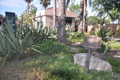
This rock is diatomaceous shale from the Miocene Monterey Formation, collected near San Luis Obispo. The Monterey is one of the most important formations to California's petroleum industry. It is rich in organic material and therefore a source of petroleum and, where fractured (as in this example), is a good reservoir. Oil and gas fields associated with this formation occur both onshore and offshore in California.
Topics. This historical marker is listed in these topic lists: Industry & Commerce • Natural Resources • Notable Places • Science & Medicine. A significant historical year for this entry is 1903.
Location. 33° 55.01′ N, 117° 58.043′ W. Marker is in La Habra, California, in Orange County. Marker is on West Imperial Highway (California Route 90) near Beach Boulevard, on the right when traveling east. Marker is located at the entrance of a carwash in a circular planter. Touch for map. Marker is at or near this postal address: 1950 West Imperial Highway, La Habra CA 90631, United States of America. Touch for directions.
Other nearby markers. At least 8 other markers are within 3 miles of this marker, measured as the crow flies. La Habra Pacific Electric Depot (approx. 1˝ miles away); La Habra's Birthplace (approx. 1.6 miles away); Stagecoach Stop (approx. 2.2 miles away); La Mirada Relay Station (approx. 2.2 miles away); The Original Hass Avocado Tree (approx. 2.6 miles away); “Jesus Saves” Historic Replica (approx. 2.8 miles away); Sutherland / Sanders Bell Tower (approx. 2.9 miles away); Zahur-ul-Haqq (approx. 2.9 miles away). Touch for a list and map of all markers in La Habra.
Credits. This page was last revised on June 16, 2016. It was originally submitted on August 29, 2012, by Michael Kindig of Elk Grove, California. This page has been viewed 1,032 times since then and 32 times this year. Photos: 1, 2. submitted on August 29, 2012, by Michael Kindig of Elk Grove, California. • Syd Whittle was the editor who published this page.

