Cupertino in Santa Clara County, California — The American West (Pacific Coastal)
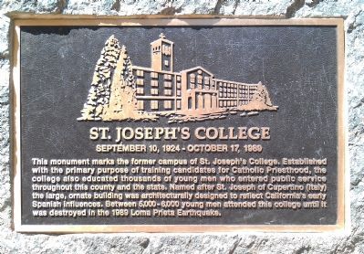
St. Joseph’s College
September 10, 1924 – October 17, 1989
Topics. This historical marker is listed in these topic lists: Churches & Religion • Education. A significant historical year for this entry is 1989.
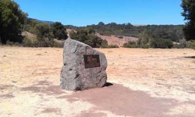
Location. 37° 20.074′ N, 122° 5.394′ W. Marker is in Cupertino, California, in Santa Clara County. Marker is on Cristo Rey Drive. This marker is located in Rancho San Antonio County Park on the Permanente Creek Trail. Touch for map. Marker is in this post office area: Cupertino CA 95014, United States of America. Touch for directions.
Other nearby markers. At least 8 other markers are within 3 miles of this marker, measured as the crow flies. Historic Loyola Corners (approx. 1.4 miles away); Captain Elisha Stephens (approx. 1.8 miles away); Arroyo de San Joseph Cupertino (approx. 2.2 miles away); William Wright Ranch (approx. 2.2 miles away); Stevens Creek Dam & Reservoir (approx. 2½ miles away); Blue and Gold Kennel Club (approx. 2.6 miles away); Collins-Scott Winery (approx. 2.7 miles away); Everyday Life at the Ranch (approx. 2.8 miles away). Touch for a list and map of all markers in Cupertino.
Also see . . . A Monument for St. Joseph''''s College - St. Joseph''''s College. On 3/11/2010 this picture was taken as the bronze plaque was installed on our rock monument to St. Joseph's Seminary and College. (Submitted on August 31, 2012, by Barry Swackhamer of Brentwood, California.)
Credits. This page was last revised on June 16, 2016. It was originally submitted on August 31, 2012, by Barry Swackhamer of Brentwood, California. This page has been viewed 1,114 times since then and 45 times this year. Photos: 1, 2. submitted on August 31, 2012, by Barry Swackhamer of Brentwood, California. • Syd Whittle was the editor who published this page.

