Charleston in Kanawha County, West Virginia — The American South (Appalachia)
Battle of Charleston
Downtown Battleground
— Jenkins's Raid —
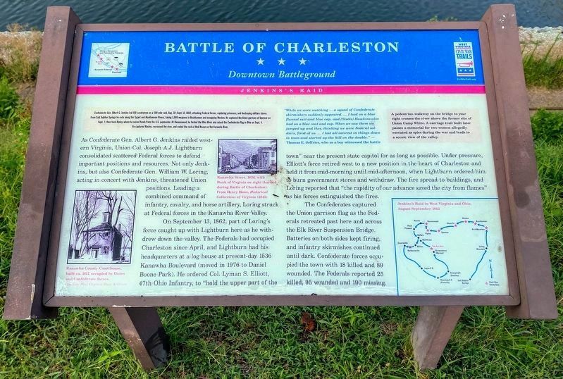
Confederate Gen. Albert G. Jenkins led 550 cavalrymen on a 500 mile raid, Aug. 22-Sept. 12, 1862, attacking Federal forces, capturing prisoners, and destroying military stores. From Salt Sulphur Springs he rode along the Tygart and Buckhannon Rivers, taking 5,000 weapons in Buckhannon and occupying Weston. He captured the Union garrison at Spencer on Sept. 2, then took Ripley, where he seized funds from the U.S. paymaster. At Ravenswood, he forded the Ohio River and raised the Confederate flag in Ohio on Sept. 4. He captured Racine, recrossed the river, and ended the raid at Red House on the Kanawha River.
As Confederate Gen. Albert G. Jenkins raided western Virginia, Union Col. Joseph A.J. Lightburn consolidated scattered Federal forces to defend important positions and resources. Not only Jenkins, but also Confederate Gen. William W. Loring, acting in concert with Jenkins, threatened Union positions. Leading a combined command of infantry, cavalry, and horse artillery, Loring struck at Federal forces in the Kanawha River Valley.
On September 13, 1862, part of Loring’s force caught up with Lightburn here as he withdrew down the valley. The Federals had occupied Charleston since April, and Lightburn had his headquarters at a log house at present-day 1536 Kanawha Boulevard (moved in 1976 to Daniel Boone Park). He ordered Col. Lyman S. Elliott, 47th Ohio Infantry, to “hold the upper part of the town” near the present state capitol for as long as possible. Under pressure, Elliott’s force retired west to a new position in the heart of Charleston and held it from mid-afternoon, when Lightburn ordered him to burn government stores and withdraw. The fire spread to buildings, and Loring reported that “the rapidity of our advance saved the city from flames” as his forces extinguished the fires.
The Confederates captured the Union garrison flag as the Federals retreated past here and across the Elk River Suspension Bridge. Batteries on both sides kept firing, and infantry skirmishes continued until dark. Confederate forces occupied the town with 18 killed and 89 wounded. The Federals reported 25 killed, 95 wounded and 190 missing.
"While we were watching ... a squad of Confederate skirmishers suddenly appeared. ... I had on a blue flannel suit and blue cap, and [Steele] Hawkins also had on a blue coat and cap. When we saw them we jumped up and they, thinking we were Federal soldiers, fired at us. ... I lost all interest in things down in town and started up the hill on the double." - Thomas E. Jeffries, who as a boy witnessed the battle
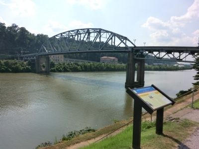
A pedestrian walkway on the bridge to your right crosses the river above the former site of Union Camp White. A carriage trail built later passes a memorial for two women allegedly executed as spies during the war and leads to a scenic view of the valley.
Erected by West Virginia Civil War Trails.
Topics and series. This historical marker is listed in this topic list: War, US Civil. In addition, it is included in the West Virginia Civil War Trails series list. A significant historical month for this entry is September 1899.
Location. 38° 20.82′ N, 81° 38.136′ W. Marker is in Charleston, West Virginia, in Kanawha County. Marker is at the intersection of Kanawha Boulevard and McFarland Street, on the right when traveling south on Kanawha Boulevard. Touch for map. Marker is at or near this postal address: 1005 Kanawha Bloulevard East, Charleston WV 25301, United States of America. Touch for directions.
Other nearby markers. At least 8 other markers are within walking distance of this marker. South Side Bridge (about 400 feet away, measured in a direct line); Kanawha United Presbyterian Church (about 500 feet away); The New Deal In Your Community (about 500 feet away); First Presbyterian Church (about 800 feet away); State Capitol Annex (approx. 0.2 miles away); Kanawha County Public Library (approx. 0.2 miles away); Saint John's Episcopal Church (approx. 0.2 miles away); First Gas Well (approx. 0.2 miles away). Touch for a list and map of all markers in Charleston.
Credits. This page was last revised on August 12, 2021. It was originally submitted on September 3, 2012, by Don Morfe of Baltimore, Maryland. This page has been viewed 1,056 times since then and 29 times this year. Photos: 1. submitted on August 12, 2021, by Shane Oliver of Richmond, Virginia. 2, 3. submitted on September 3, 2012, by Don Morfe of Baltimore, Maryland. • Craig Swain was the editor who published this page.


