El Paso in El Paso County, Texas — The American South (West South Central)
Fusselman Canyon
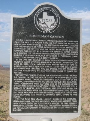
In the late 19th Century, El Paso was a booming town, but outlying areas were still plagued by frontier conditions. On April 17, 1890, local rancher John Barnes reported that his horses and cattle has been stolen. Later that day, Charles Fusselman was deputized and led Barnes and city policeman George Herold into the Franklin Mountains to chase the rustlers.
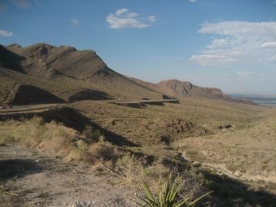
The thieves intended to drive the horses and cattle through the canyon (along the path of today's Woodrow Bean Trans Mountain Road), through Smuggler's Gap at the top of the canyon, and then into the Rio Grande Bosque near Canutillo, Texas. Fusselman's party captured one of the rustlers before encountering the outlaws' camp. There they were met with a barrage of gunfire, and Fusselman was shot and killed. The outlaws escaped after the outnumbered Barnes and Herold left their prisoner and fled the scene. Fusselman's body was later recovered and taken to Lagarto, Texas, where he was buried.
For the next ten years, lawmen pursued the rustlers. Geronimo Parra, the outlaw leader, was finally arrested, tried and found guilty of Fusselman's murder. He was legally hanged in January 1900 in El Paso. The canyon became known as Fusselman Canyon in honor of the slain deputy and ranger.
Erected 2002 by Texas Historical Commission. (Marker Number 12913.)
Topics. This historical marker is listed in this topic list: Notable Places. A significant historical month for this entry is January 1900.
Location. 31° 53.626′ N, 106° 28.303′ W. Marker is in El Paso, Texas, in El Paso County. Marker is on Woodrow Bean Transmountain Road (State Highway 375) 2˝ miles west of Patriot Freeway (U.S. 54), on the right when traveling east. Touch for map. Marker is in this post office area: El Paso TX 79904, United States of America. Touch for directions.
Other nearby markers. At least 8 other markers are within 6 miles of this marker, measured as the crow flies. Mexican War Refugee Camp (approx. 5.6 miles away); V2 Rocket (approx. 5.6 miles away); "General of the Army Omar N. Bradley Flagpole" (approx. 5.6 miles away); AH-1F COBRA Attack Helicopter (approx. 5.6 miles away); Pearl Harbor Memorial
(approx. 5.6 miles away); Building 1372 (approx. 6 miles away); Building 1355 (approx. 6 miles away); Historical Building 241 - The Guardhouse, 1893 (approx. 6 miles away).
Credits. This page was last revised on June 16, 2016. It was originally submitted on September 4, 2012, by Jennifer W. of Las Cruces, New Mexico. This page has been viewed 1,539 times since then and 106 times this year. Photos: 1, 2. submitted on September 4, 2012, by Jennifer W. of Las Cruces, New Mexico. 3. submitted on May 11, 2014, by Richard Denney of Austin, Texas. • Bernard Fisher was the editor who published this page.


