Hays in Ellis County, Kansas — The American Midwest (Upper Plains)
Fort Hays
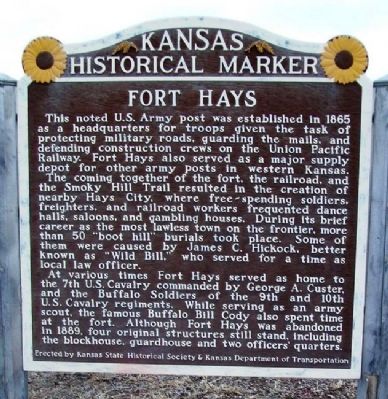
This noted U.S. Army post was established in 1865 as a headquarters for troops given the task of protecting military roads, guarding the mails and defending construction crews on the Union Pacific Railway. Fort Hays also served as a major supply depot for other army posts in western Kansas.
The coming together of the fort, the railroad, and the Smoky Hill Trail resulted in the creation of nearby Hays City, where free-spending soldiers, freighters, and railroad workers frequented dance halls, saloons, and gambling houses. During its brief career as the most lawless town on the frontier, more than 50 "boot hill" burials took place. Some of them were caused by James C. Hickock, better known as "Wild Bill," who served for a time as local law officer.
At various times Fort Hays served as home to the 7th U.S. Cavalry commanded by George A. Custer, and the Buffalo Soldiers of the 9ths and 10th U.S Cavalry regiments. While serving as an army scout, the famous Buffalo Bill Cody also spent time at the fort. Although Fort Hays was abandoned in 1889, four original structures still stand, including the blockhouse, guardhouse, and two officers' quarters.
Erected by Kansas State Historical Society & Kansas Department of Transportation. (Marker Number 41.)
Topics and series. This historical marker is listed in these topic lists: Communications • Forts and Castles • Railroads & Streetcars • Wars, US Indian. In addition, it is included in the Buffalo Soldiers, the Kansas Historical Society, and the Postal Mail and Philately series lists. A significant historical year for this entry is 1865.
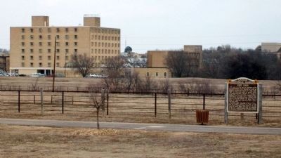
Location. 38° 51.849′ N, 99° 20.579′ W. Marker is in Hays, Kansas, in Ellis County. Marker is on Bypass U.S. 183, 0.1 miles south of Golf Course Road, on the left when traveling south. Marker is at a roadside pulloff. Touch for map. Marker is in this post office area: Hays KS 67601, United States of America. Touch for directions.
Other nearby markers. At least 8 other markers are within walking distance of this marker. Monarch of the Plains (about 300 feet away, measured in a direct line); Time Capsule (about 300 feet away); Commissary Warehouse (about 300 feet away); Commanding Officer's House (about 500 feet away); Elizabeth Bacon Custer (about 500 feet away); Parade Ground
(about 500 feet away); a different marker also named Fort Hays (about 500 feet away); Officers' Row (about 500 feet away). Touch for a list and map of all markers in Hays.
Also see . . .
1. Fort Hays State Historic Site. (Submitted on September 6, 2012, by William Fischer, Jr. of Scranton, Pennsylvania.)
2. Fort Hays at Kansapedia. (Submitted on September 6, 2012, by William Fischer, Jr. of Scranton, Pennsylvania.)
Credits. This page was last revised on September 3, 2020. It was originally submitted on September 6, 2012, by William Fischer, Jr. of Scranton, Pennsylvania. This page has been viewed 625 times since then and 24 times this year. Photos: 1, 2. submitted on September 6, 2012, by William Fischer, Jr. of Scranton, Pennsylvania.

