Kingston in Ulster County, New York — The American Northeast (Mid-Atlantic)
Sections of the “Old Stone Road”
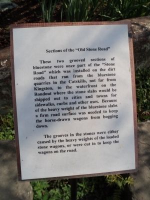
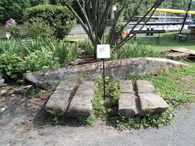
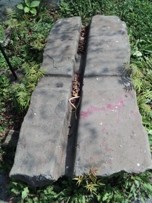
These two grooved sections of bluestone were once part of the “Stone Road” which was installed on the dirt roads that ran from the bluestone quarries in the Catskills, not far from Kingston, to the waterfront on the Rondout where the stone slabs would be shipped out to cities and towns for sidewalks, curbs and other uses. Because of the heavy weight of the bluestone slabs a firm road surface was needed to keep the horse-drawn wagons from bogging down.
The grooves in the stones were either caused by the heavy weight of the loaded stone wagons, or were cut in to keep the wagons on the road.
Topics. This historical marker is listed in this topic list: Roads & Vehicles.
Location. 41° 55.116′ N, 73° 58.881′ W. Marker is in Kingston, New York, in Ulster County. Marker is at the intersection of E Strand Street and Broadway, on the left when traveling west on E Strand Street. Marker is located near the Hudson River Maritime Museum, on the Kingston riverfront. Touch for map. Marker is in this post office area: Kingston NY 12401, United States of America. Touch for directions.
Other nearby markers. At least 8 other markers are within walking distance of this marker. Mary Powell Bell (here, next to this marker); 1898 Mathilda Steam Engine (a few steps from this marker); Rondout-Sleighsburg Ferry: Riverside, a.k.a. Skillypot (within shouting distance of this marker); The Tugboat Mathilda (within shouting distance of this marker); Fulton’s Playground: Fun with Steamboats (within shouting distance of this marker); Romer & Tremper Steamboat Dock (within shouting distance of this marker); The Cornell Steamboat Company (about 300 feet away, measured in a direct line); The Mary Powell: Queen Of The Hudson (about 300 feet away). Touch for a list and map of all markers in Kingston.
Credits. This page was last revised on June 16, 2016. It was originally submitted on September 7, 2012, by Bill Coughlin of Woodland Park, New Jersey. This page has been viewed 460 times since then and 13 times this year. Photos: 1, 2, 3, 4. submitted on September 7, 2012, by Bill Coughlin of Woodland Park, New Jersey.


