Beaufort in Beaufort County, South Carolina — The American South (South Atlantic)
Beaufort County, South Carolina
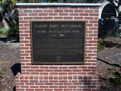
Colonial And Revolutionary Period
— 1711-1860 —
Inscription.
During the Colonial period the Beaufort district grew and prospered. Rice was produced for export on the mainland, indigo in the sea islands, shipbuilding flourished. The Parish System developed as the political basis and Beaufort competed with Charleston for prestige and influence.
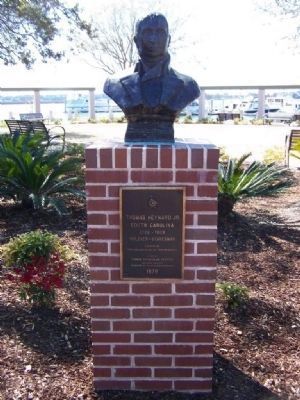
Until 1779 Beaufort played little part in the Revolution. Early in that year the first British attempt to take the town was repulsed by General William Moultrie's Militia at the Battle of Port Royal Island. The same year Beaufort was occupied by British forces. Patriots and Tories fought bitterly throughout the area to the end of 1782. Beaufort's most prominent patriot was Thomas Heyward Jr., signer of the Declaration of Independence.
After slow recovery from the war's depletion, the introduction of sea island cotton in 1799 brought a rapid increase in plantations and slaves. New wealth provided Beaufort's elegant homes, fine libraries and some of the best preparatory schools in the south between 1800 and 1860, including Beaufort College. So many men of the state and national prominence were produces that ante-bellum Beaufort was described as the "wealthiest, most aristocratic and cultivating town of its size in America." It was an economy based upon cotton undergirded by slavery.
Erected 2007 by Beaufort County.
Topics. This historical marker is listed in these topic lists: Colonial Era • Horticulture & Forestry • Industry & Commerce • Patriots & Patriotism • War, US Revolutionary. A significant historical year for this entry is 1779.
Location. 32° 25.828′ N, 80° 40.384′ W. Marker is in Beaufort, South Carolina, in Beaufort County. Marker is in Henry C. Chambers Waterfront Park, along the Beaufort River. Touch for map. Marker is in this post office area: Beaufort SC 29902, United States of America. Touch for directions.
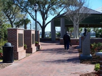
Other nearby markers. At least 8 other markers are within walking distance of this marker. A different marker also named Beaufort County, South Carolina (here, next to this marker); Thomas Heyward, Jr. (here, next to this marker); Beaufort County South Carolina (here, next to this marker); Verdier House (about 600 feet away, measured in a direct line); The Capt. Francis Saltus House (about 700 feet away); Beaufort South Carolina Tricentennial (about 700 feet away); The Sam Levin Building (about 700 feet away); Tabernacle Baptist Church (approx. 0.2 miles away). Touch for a list and map of all markers in Beaufort.
Regarding Beaufort County, South Carolina. "in·di·go "
a. Any of various shrubs or herbs of the genus Indigofera in the pea family, having odd-pinnate leaves and usually red or purple flowers in axillary
racemes.
b. A blue dye obtained from these plants
Also see . . . Wikipedia entry for Thomas Heyward, Jr. ...was a signer of the United States Declaration of Independence as a representative of South Carolina. (Submitted on March 3, 2008, by Mike Stroud of Bluffton, South Carolina.)
Credits. This page was last revised on February 2, 2020. It was originally submitted on March 3, 2008, by Mike Stroud of Bluffton, South Carolina. This page has been viewed 1,673 times since then and 37 times this year. Photos: 1, 2, 3. submitted on March 3, 2008, by Mike Stroud of Bluffton, South Carolina. • Kevin W. was the editor who published this page.


