Hurricane in Washington County, Utah — The American Mountains (Southwest)
The Town Named After a Buggy Incident
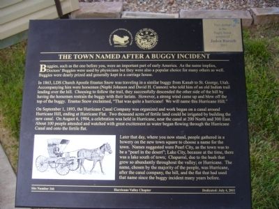
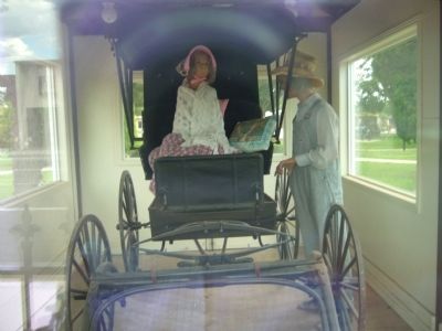
In 1863, LDS Church Apostle Erastus Snow was traveling in a similar buggy from Kanab to St. George, Utah. Accompanying him were horsemen (Nephi Johnson and David H. Cannon) who told him of an old Indian trail leading over the hill. Choosing to follow the trail, they successfully descended the other side of the hill by having the horsemen restrain the buggy with their lariats. However, a strong wind came up and blew off the top of the buggy. Erastus Snow exclaimed, "That was quite a hurricane! We will name this Hurricane Hill."
On September 1, 1893, the Hurricane Canal Company was organized and work began on a canal around Hurricane Hill, ending at Hurricane Flat. Two thousand acres of fertile land could be irrigated by building the new canal. On August 6, 1904, a celebration was held in Hurricane, near the canal at 200 North and 300 East. About 100 people attended and watched with great excitement as water began flowing through the Hurricane Canal and onto the fertile flat.
Later that day, where you now stand, people gather in a bowery on the new town square to choose a name for the town. Names suggested were Pearl City, as the town was to be a "pearl in the desert", Lake City, because at the time, there was a lake south of town; Chaparral, due to the bush that grew so abundantly throughout the valley; or Hurricane, after the canal company, the hill, and the flat that had used that name since the buggy incident many years before.
Erected 2011 by Hurricane Valley Chapter, Sons of Utah Pioneers. (Marker Number 166.)
Topics and series. This historical marker is listed in this topic list: Settlements & Settlers. In addition, it is included in the Sons of Utah Pioneers series list. A significant historical month for this entry is September 1857.
Location. 37° 10.582′ N, 113° 17.31′ W. Marker is in Hurricane, Utah, in Washington County. Marker can be reached from West State Street. Marker is in Hurricane Valley Pioneer Heritage Park. Touch for map. Marker is at or near this postal address: 35 West State Street, Hurricane UT 84737, United States of America. Touch for directions.
Other nearby markers. At least 8 other markers are within walking distance of this marker. Many Came by Handcart (a few steps from this marker); Early Day Wood Beam Walking Hand Plow (a few steps from this marker); Pioneer Gratitude (a few steps from this marker); Historic Kolob Mountain (a few steps from this marker); Smith Mesa (a few steps from this marker); Survival in Utah’s Dixie (a few steps from this marker); The Roads to Utah’s Dixie (within shouting distance of this marker); Hurricane Canal (within shouting distance of this marker). Touch for a list and map of all markers in Hurricane.
Credits. This page was last revised on June 16, 2016. It was originally submitted on September 10, 2012, by Bill Kirchner of Tucson, Arizona. This page has been viewed 454 times since then and 7 times this year. Photos: 1, 2, 3. submitted on September 10, 2012, by Bill Kirchner of Tucson, Arizona. • Bill Pfingsten was the editor who published this page.


