Hurricane in Washington County, Utah — The American Mountains (Southwest)
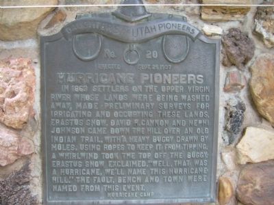
Hurricane Pioneers
Erected 1937 by Daughters of Utah Pioneers – Hurricane Camp. (Marker Number 20.)
Topics and series. This historical marker is listed in this topic list: Settlements & Settlers. In addition, it is included in the Daughters of Utah Pioneers series list. A significant historical year for this entry is 1863.
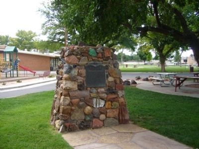
Location. 37° 10.561′ N, 113° 17.322′ W. Marker is in Hurricane, Utah, in Washington County. Marker can be reached from West State Street. Marker is in Hurricane Valley Pioneer Heritage Park. Touch for map. Marker is at or near this postal address: 35 West State Street, Hurricane UT 84737, United States of America. Touch for directions.
Other nearby markers. At least 8 other markers are within walking distance of this marker. Hurricane City (a few steps from this marker); Hurricane Canal (a few steps from this marker); The Roads to Utah’s Dixie (a few steps from this marker); Pioneer Trails (a few steps from this marker); Survival in Utah’s Dixie (a few steps from this marker); Smith Mesa (within shouting distance of this marker); Pioneer Gratitude (within shouting distance of this marker); Early Day Wood Beam Walking Hand Plow (within shouting distance of this marker). Touch for a list and map of all markers in Hurricane.
Credits. This page was last revised on June 16, 2016. It was originally submitted on September 11, 2012, by Bill Kirchner of Tucson, Arizona. This page has been viewed 443 times since then and 16 times this year. Photos: 1, 2. submitted on September 11, 2012, by Bill Kirchner of Tucson, Arizona. • Bill Pfingsten was the editor who published this page.

