La Verkin in Washington County, Utah — The American Mountains (Southwest)
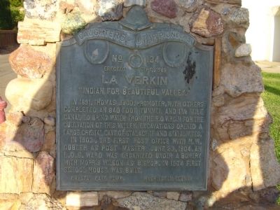
La Verkin
"Indian for Beautiful Valley"
In 1903, the first post office with H.W. Gubler as post master. June 23, 1904, an L.D.S. Ward was organized under a bowery with Morris Wilson as bishop, in 1904 first school house was built.
Erected 1949 by Daughters of Utah Pioneers – Crystal Cave Camp. (Marker Number 134.)
Topics and series. This historical marker is listed in these topic lists: Bridges & Viaducts • Education • Settlements & Settlers. In addition, it is included in the Daughters of Utah Pioneers series list. A significant historical date for this entry is June 23, 1858.
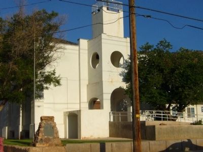
Location. 37° 11.962′ N, 113° 16.17′ W. Marker is in La Verkin, Utah, in Washington County. Marker is at the intersection of South Main Street and West 100 South, on the right when traveling north on South Main Street. Marker is on the southeast corner. Touch for map. Marker is in this post office area: La Verkin UT 84745, United States of America. Touch for directions.
Other nearby markers. At least 8 other markers are within 2 miles of this marker, measured as the crow flies. Hurricane/LaVerkin Bridge (approx. 0.7 miles away); La Verkin Canal (approx. 0.8 miles away); Southern Exploring Company – 1849 (approx. 0.8 miles away); Hurricane Canal (approx. 0.9 miles away); Southern Exploring Company - 1849 (approx. 1.1 miles away); The Historic Hurricane Canal (approx. 1.2 miles away); The Historic Dixie-Long Valley, Utah Pioneer Trail (approx. 1.2 miles away); Look-out Point (approx. 1.3 miles away). Touch for a list and map of all markers in La Verkin.
Credits. This page was last revised on June 16, 2016. It was originally submitted on September 13, 2012, by Bill Kirchner of Tucson, Arizona. This page has been viewed 763 times since then and 50 times this year. Photos: 1, 2. submitted on September 13, 2012, by Bill Kirchner of Tucson, Arizona. • Bill Pfingsten was the editor who published this page.

