La Verkin in Washington County, Utah — The American Mountains (Southwest)
La Verkin Canal
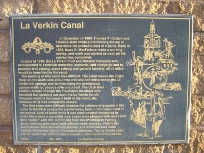
In June of 1889, the La Verkin Fruit and Nursery Company was incorporated to establish nurseries, orchards, and vineyards and to promote fruit raising, stock raising and general farming, all of which would be benefited by the canal.
The building of this canal was difficult. The canal leaves the Virgin River on the north side about two and one-half miles above the La Verkin hot springs and follows along the precipitous canyon walls for about a mile and a half. The ditch then enters a tunnel through the mountains for about nine hundred feet opening out upon the La Verkin bench. Because most of the canal is built in the rocks, the builders felt it was completely secure.
The first years were difficult because the patches of gypsum in the rocks in the ditch constantly melted away, both in the canyon and in the tunnel. Lack of water when it was most needed threatened to make the project a complete loss. Leaks were plugged with rocks and then "pulled" with dirt. Cotton lint from the Washington Factory, straw, and bagasse were used without much success. Finally the worst places were flumed with lumber, and water became more certain. Water was vital to the western pioneers. The La Verkin canal was an extremely difficult, but successful, solution to this problem.
Erected 1994 by Daughters of Utah Pioneers – La Verkin Camp. (Marker Number 474.)
Topics and series. This historical marker is listed in these topic lists: Agriculture • Bridges & Viaducts • Settlements & Settlers. In addition, it is included in the Daughters of Utah Pioneers series list. A significant historical month for this entry is June 1889.
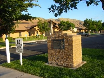
Location. 37° 12.645′ N, 113° 16.255′ W. Marker is in La Verkin, Utah, in Washington County. Marker is on West 500 North, on the right when traveling east. Marker is at entrance to LDS Church parking lot. Touch for map. Marker is in this post office area: La Verkin UT 84745, United States of America. Touch for directions.
Other nearby markers. At least 8 other markers are within 2 miles of this marker, measured as the crow flies. La Verkin (approx. 0.8 miles away); Southern Exploring Company – 1849 (approx. one mile away); Southern Exploring Company - 1849 (approx. 1.4 miles away); Hurricane/LaVerkin Bridge (approx. 1˝ miles away); Hurricane Canal (approx. 1.6 miles away); Look-out Point (approx. 1.8 miles away); The Historic Hurricane Canal (approx. 2 miles away); The Historic Dixie-Long Valley, Utah Pioneer Trail (approx. 2 miles away). Touch for a list and map of all markers in La Verkin.
Credits. This page was last revised on June 16, 2016. It was originally submitted on September 13, 2012, by Bill Kirchner of Tucson, Arizona. This page has been viewed 754 times since then and 97 times this year. Photos: 1, 2. submitted on September 13, 2012, by Bill Kirchner of Tucson, Arizona. • Syd Whittle was the editor who published this page.

