Toquerville in Washington County, Utah — The American Mountains (Southwest)
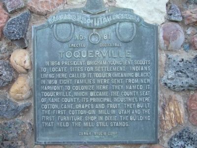
Toquerville
Erected 1941 by Daughters of Utah Pioneers – Sarah Wills Camp. (Marker Number 81.)
Topics and series. This historical marker is listed in this topic list: Settlements & Settlers. In addition, it is included in the Daughters of Utah Pioneers series list. A significant historical year for this entry is 1854.
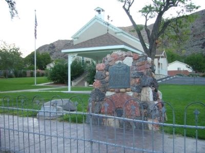
Location. 37° 15.283′ N, 113° 17.1′ W. Marker is in Toquerville, Utah, in Washington County. Marker is at the intersection of Utah Route 17 and East Old Church Road, on the right when traveling north on State Route 17. Marker is on the northeast corner. Touch for map. Marker is in this post office area: Toquerville UT 84774, United States of America. Touch for directions.
Other nearby markers. At least 8 other markers are within 5 miles of this marker, measured as the crow flies. Toquer (here, next to this marker); In Honor of Chief Toquer (a few steps from this marker); La Verkin Canal (approx. 3.1 miles away); Southern Exploring Company – 1849 (approx. 3.7 miles away); La Verkin (approx. 3.9 miles away); Southern Exploring Company - 1849 (approx. 4.1 miles away); A Tale of Three Towns (approx. 4.2 miles away); From Schoolhouse to Town Hall (approx. 4.2 miles away). Touch for a list and map of all markers in Toquerville.
Credits. This page was last revised on June 16, 2016. It was originally submitted on September 14, 2012, by Bill Kirchner of Tucson, Arizona. This page has been viewed 461 times since then and 18 times this year. Photos: 1, 2. submitted on September 14, 2012, by Bill Kirchner of Tucson, Arizona. • Bill Pfingsten was the editor who published this page.

