Bristow in Prince William County, Virginia — The American South (Mid-Atlantic)
Cemeteries
Bristoe Station
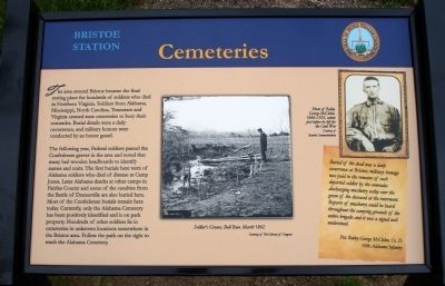
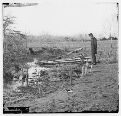
The following year, Federal soldiers passed the Confederate graves in the area and noted that many had wooden headboards to identify names and units. The first burials here were of Alabama soldiers who died of disease at Camp Jones. Later Alabama deaths at other camps in Fairfax County and some of the casulties from the Battle of Dranesville are also buried here. Most of the Confederate burials remain here today. Currently, only the Alabama Cemetery has been positively identified and is on park property. Hundreds of other soldiers lie in cemeteries in unknown locations somewhere in the Bristoe area. Follow the path on the right to reach the Alabama Cemetery.
(Sidebar): Burial of the dead was a daily occurrence at Bristoe; military homage was paid to the remains of each departed soldier by the comrades discharging musketry volley over the graves of the deceased at the interment. Reports of musketry could be heard throughout the camping grounds of the entire brigade and it was a signal well understood. Pvt. Bailey George McClelen, Co. D. 10th Alabama Infantry
Erected 2012 by Prince William County Department of Public Works, Historic Preservation Division.
Topics. This historical marker is listed in this topic list: War, US Civil.
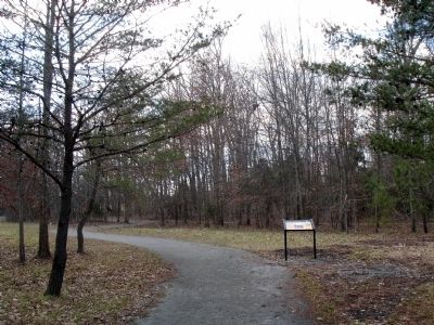
Location. 38° 43.536′ N, 77° 32.779′ W. Marker is in Bristow, Virginia, in Prince William County. Marker can be reached from Iron Brigade Unit Ave.. Marker is located on the 1861-1862 Trail at Bristoe Station Battlefield Heritage Park. Touch for map. Marker is in this post office area: Bristow VA 20136, United States of America. Touch for directions.
Other nearby markers. At least 8 other markers are within walking distance of this marker. Here Lie Men from the State of Alabama (within shouting distance of this marker); Alabama Cemetery (within shouting distance of this marker); Camp Jones (about 400 feet away, measured in a direct line); Federal Winter Quarter (about 400 feet away); Bristoe 1861-1862 Trail (about 700 feet away); Roads to Bristoe Station (about 700 feet away); Confederates in Bristoe (about 800 feet away); Confederate Cemeteries (approx. 0.2 miles away). Touch for a list and map of all markers in Bristow.
More about this marker. Then center of the marker displays a photo captioned Soldier's Graves, Bull Run, March 1862 Courtesy of The Library of Congress. On the upper right of the marker is a portrait captioned Photo of George McClelen, 1840-1925, taken just before he left for the Civil War Courtesy of Rourke Communications.
Credits. This page was last revised on June 10, 2020. It was originally submitted on September 14, 2012. This page has been viewed 766 times since then and 21 times this year. Photos: 1, 2, 3. submitted on March 6, 2013. • Craig Swain was the editor who published this page.


