Near Sharpsburg in Washington County, Maryland — The American Northeast (Mid-Atlantic)
William's Division, Twelfth Army Corps
Williams' Division, Twelfth Army Corps,
Brig. Gen. Alpheus S. Williams, Commanding.
(September 17, 1862.)
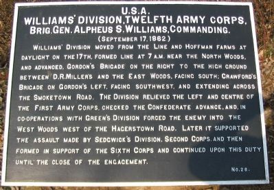
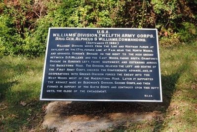
Williams' Division moved from the Line and Hoffman Farms at daylight on the 17th, formed line at 7 a.m. near the North Woods, and advanced, Gordon's Brigade on the right to the high ground between D.R. Miller's and the East Woods, facing south; Crawford's Brigade on Gordon's left, facing southwest, and extending across the Smoketown Road. The Division relieved the left and centre of the First Army Corps, checked the Confederate advance, and, in co-operations with Green's Division forced forced the enemy into the West Woods west of the Hagerstown Road. Later it supported the assault made by Sedgwick's Division, Second Corps, and then formed in support of the Sixth Corps and continued upon this duty until the close of the engagement.
Erected by Antietam Battlefield Board. (Marker Number 28.)
Topics and series. This historical marker is listed in this topic list: War, US Civil. In addition, it is included in the Antietam Campaign War Department Markers series list. A significant historical date for this entry is September 17, 1862.
Location. 39° 29.064′ N, 77° 44.567′ W. Marker is near Sharpsburg, Maryland, in Washington County. Marker is at the intersection of Mansfield Avenue and Smoketown Road, on the left when traveling east on Mansfield Avenue. Located at a "dogleg" of Mansfield Avenue before the intersection with the Smoketown Road. Touch for map. Marker is in this post office area: Sharpsburg MD 21782, United States of America. Touch for directions.
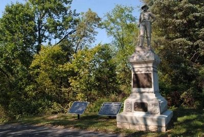
Other nearby markers. At least 10 other markers are within walking distance of this marker. Twelfth Army Corps (here, next to this marker); 12th Pennsylvania Cavalry (here, next to this marker); a different marker also named Twelfth Army Corps (a few steps from this marker); First Army Corps (within shouting distance of this marker); a different marker also named First Army Corps (about 400 feet away, measured in a direct line); Greene's Division, Twelfth Army Corps. (about 400 feet away); a different marker also named Twelfth Army Corps (about 400 feet away); a different marker also named Twelfth Army Corps (about 400 feet away); Mansfield (about 500 feet away); Major General Joseph K. F. Mansfield (about 600 feet away). Touch for a list and map of all markers in Sharpsburg.
Regarding William's Division, Twelfth Army Corps. This marker is included on the East Woods Virtual Tour by Markers see the Virtual tour link below to see the markers in sequence.
Related markers. Click here for a list of markers that are related to this marker. William's (1nd) Division, XII Corps Markers
Also see . . .
1. Antietam Battlefield. National Park Service site. (Submitted on March 4, 2008, by Craig Swain of Leesburg, Virginia.)
2. 1st Division, XII Corps. Command of the division passed to Brig. Gen. Samuel Crawford, when Williams replaced the mortally wounded Mansfield. Crawford was later wounded and the other brigade commander, Brig. Gen. George H. Gordon assumed command. (Submitted on March 4, 2008, by Craig Swain of Leesburg, Virginia.)
3. Alpheus S. Williams. Alpheus Starkey Williams (September 29, 1810 – December 21, 1878) was a lawyer, judge, journalist, U.S. Congressman, and a Union general in the American Civil War. (Submitted on October 26, 2015, by Brian Scott of Anderson, South Carolina.)
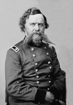
Photographed By Brian Scott, September 19, 2015
5. Major General Alpheus S. Williams (1810-1878)
The corps commander, Maj. Gen. Joseph K. Mansfield, was killed early at Antietam, and Williams assumed temporary command. The corps suffered 25% casualties in assaulting Jackson, and Brig. Gen. George S. Greene's division was forced to withdraw from its advanced position at the Dunker Church.
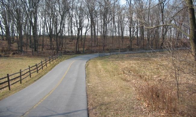
Photographed By Craig Swain, February 9, 2008
6. Gordon's Brigade
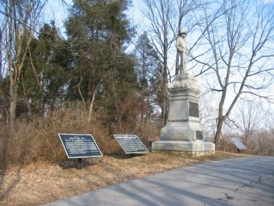
Looking west from the marker location toward the "dog leg" of Mansfield Avenue. The East Woods stood on the left and front, beyond the road. Gordon's Brigade advanced from the right, through this portion of the woods and faced the eastern end of the cornfield. The brigade relieved Christian's and Hartsuff's Brigades on the line. Crawford's Brigade was on the other side of the woods (over the low rise in the background), and relieved portions of Meade's Division.
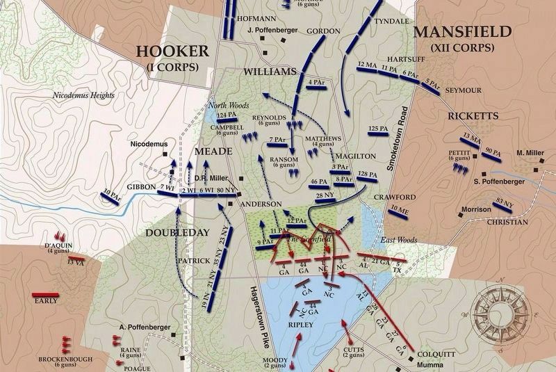
via American Battlefield Trust, unknown
7. East Woods Virtual Tour by Markers.
A collection of markers interpreting the action of during the Battle of Antietam around the East Woods.
(Submitted on March 8, 2008, by Craig Swain of Leesburg, Virginia.)
Click for more information.
(Submitted on March 8, 2008, by Craig Swain of Leesburg, Virginia.)
Click for more information.
Credits. This page was last revised on April 4, 2022. It was originally submitted on March 4, 2008, by Craig Swain of Leesburg, Virginia. This page has been viewed 715 times since then and 11 times this year. Photos: 1. submitted on March 4, 2008, by Craig Swain of Leesburg, Virginia. 2. submitted on October 26, 2015, by Brian Scott of Anderson, South Carolina. 3. submitted on March 3, 2008, by Craig Swain of Leesburg, Virginia. 4, 5. submitted on October 26, 2015, by Brian Scott of Anderson, South Carolina. 6. submitted on March 4, 2008, by Craig Swain of Leesburg, Virginia. 7. submitted on April 4, 2022, by Larry Gertner of New York, New York.
