Near Connellsville in Fayette County, Pennsylvania — The American Northeast (Mid-Atlantic)
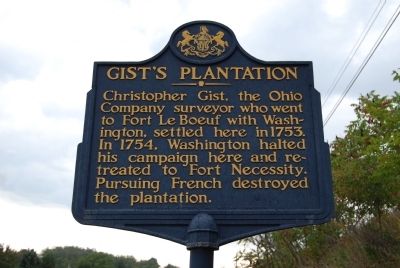
Gist's Plantation
Erected by Pennsylvania Historical and Museum Commission.
Topics and series. This historical marker is listed in these topic lists: Forts and Castles • War, French and Indian. In addition, it is included in the Pennsylvania Historical and Museum Commission series list. A significant historical year for this entry is 1753.
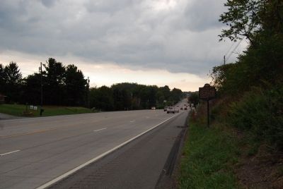
Location. 39° 57.298′ N, 79° 39.099′ W. Marker is near Connellsville, Pennsylvania, in Fayette County. Marker is on University Drive (U.S. 119) 0.1 miles south of Cellurale Drive, on the right when traveling north. Touch for map. Marker is in this post office area: Connellsville PA 15425, United States of America. Touch for directions.
Other nearby markers. At least 8 other markers are within 3 miles of this marker, measured as the crow flies. Meason House (about 600 feet away, measured in a direct line); Fayette Campus (approx. 0.6 miles away); Connellsville Coke Region (approx. 0.7 miles away); Veterans Memorial (approx. 0.9 miles away); In Honor of Those Who Serve - For God and Country (approx. 2.2 miles away); a different marker also named In Honor of Those Who Serve - For God and Country (approx. 2.2 miles away); Dunbar Korean War Memorial (approx. 2.2 miles away); a different marker also named Dunbar Korean War Memorial (approx. 2.2 miles away).
More about this marker. Marker is located near the Meason House marker, Route 119 is fast and the shoulder is tight, use caution when visiting this marker
Also see . . . Gist''s Plantation - Behind the Marker. ExplorePAHistory.com (Submitted on September 22, 2012, by Mike Wintermantel of Pittsburgh, Pennsylvania.)
Credits. This page was last revised on June 16, 2016. It was originally submitted on September 22, 2012, by Mike Wintermantel of Pittsburgh, Pennsylvania. This page has been viewed 1,376 times since then and 143 times this year. Photos: 1, 2. submitted on September 22, 2012, by Mike Wintermantel of Pittsburgh, Pennsylvania.

