Powell in Navarro County, Texas — The American South (West South Central)
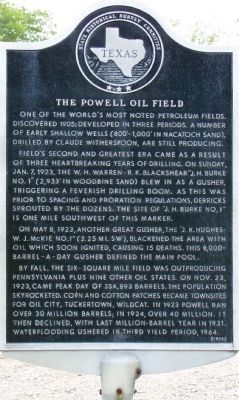
The Powell Oil Field

Photographed by Jeff Leichsenring, August 31, 2026
1. The Powell Oil Field Marker
this page online
Marker in memory of Mr. and Mrs. J. H. Burke and W. H. Warren sponsored by Mr. and Mrs. Paul J. Sloan
Erected 1973 by State Historical Survey Committee. (Marker Number 11624.)
Topics. This historical marker is listed in this topic list: Industry & Commerce. A significant historical date for this entry is May 8, 1923.
Location. 32° 7.047′ N, 96° 19.58′ W. Marker is in Powell, Texas, in Navarro County. It is on 1st Street (State Highway 31) near Carr Street, on the right when traveling east. Touch for map. Marker is in this post office area: Powell TX 75153, United States of America. Touch for directions.

Regionally, this marker is in the Prairies & Lakes Region. It is also in the American South. Globally, it is in North America, a Gulf of Mexico state, the Western Hemisphere, the Western World, and the Anglosphere. Historically, it finds itself in what was once New Spain, the Republic of Texas, and one of the Confederate States of America.
Other nearby markers. At least 8 other markers are within 8 miles
Photographed by Mike Stroud, September 17, 2012
2. The Powell Oil Field Marker
Regarding The Powell Oil Field. Encouraged by nearby discoveries in Mexia and Wortham, the Corsicana Deep Well Company announced plans to drill for oil in the Powell area in the June 9, 1919 issue of the Corsicana Daily Sun. However the drilling effort yielded a dry hole and was abandoned six months later.
A second attempt also failed. Finally, on January 7, 1923, now more than three years from the announcement, oil was found.
By July 14, 17 wells were in operation. Seven more came in on a single day, August 1, 1923. Soon the Powell field was pumping more oil than the combined oil production of the day in the states of Colorado, Illinois, Iowa, Kansas, Kentucky, New York, Ohio, Pennsylvania, Tennessee, and West Virginia.
The Powell oil field produced wealth and tragedy in great proportions. On May 10, 1923, a spark ignited the derrick floor. The fire caused 13 men to die from horrible burns.
At peak production the Powell field boasted more than 500 pumping wells and produced some 354,000 barrels (56,300 m3) of oil per day.
By the late 1920s the Powell field had been pumped dry and was abandoned. (Wikipedia)
Additional commentary.
1. Waterflooding
[Enhanced Oil Recovery, Well Completions]
A method of secondary recovery in which water is injected into the reservoir formation to displace residual oil. The water from injection wells physically
Photographed by Mike Stroud, September 17, 2012
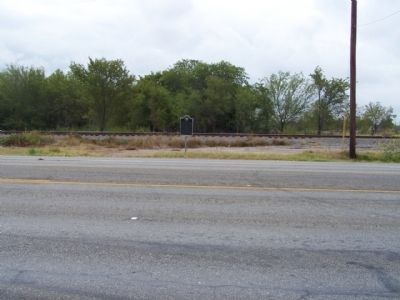
3. The Powell Oil Field Marker
— Submitted September 28, 2012, by Mike Stroud of Bluffton, South Carolina.
Photographed by Mike Stroud, September 17, 2012
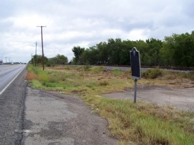
4. The Powell Oil Field Marker, looking east along Texas Route 31
Credits. This page was last revised on September 1, 2026. It was originally submitted on September 23, 2012, by Mike Stroud of Bluffton, South Carolina. This page has been viewed 2,303 times since then and 166 times this year. Photos: 1. submitted on August 31, 2026, by Jeff Leichsenring of Garland, Texas. 2, 3, 4. submitted on September 28, 2012, by Mike Stroud of Bluffton, South Carolina.
