Near Staunton in Augusta County, Virginia — The American South (Mid-Atlantic)
Augusta County Training School

Photographed by J. J. Prats, September 23, 2012
1. Augusta County Training School Marker
Erected 2006 by Department of Historic Resources. (Marker Number W-231.)
Topics and series. This historical marker is listed in these topic lists: African Americans • Education. In addition, it is included in the Virginia Department of Historic Resources (DHR) series list. A significant historical year for this entry is 1874.
Location. 38° 8.81′ N, 79° 7.88′ W. Marker is near Staunton, Virginia, in Augusta County. It is on Cedar Green Road 0.2 miles Parkersburg Turnpike (Virginia Route
this page online

Regionally, this marker is in the Shenandoah Valley. It is also in the American South and specifically in the Upper South. Globally, it is in North America, the Western Hemisphere, the Western World, and the Anglosphere. Historically, it finds itself in what was once the territory of the Mississippian Culture, one of the original Thirteen Colonies, one of the Confederate States of America, and the Antebellum South.
Other nearby markers. At least 8 other markers are within 3 miles of this marker, measured as the crow flies: Queen Miller Home (approx. 1.2 miles away); The Long Road to Freedom (approx. 2.1 miles away); A Mansion in the New Republic: (approx. 2.1 miles away); Farming and Freedom at Montgomery Hall (approx. 2.1 miles away); Montgomery Hall (approx. 2.1 miles away); Held in Bondage (approx. 2.1 miles away); Shining Light on Their Humanity (approx. 2.1 miles away); An African American Haven Becomes Reality (approx. 2.1 miles away).
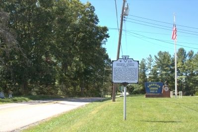
Photographed by J. J. Prats, September 23, 2012
2. Augusta County Training School Marker
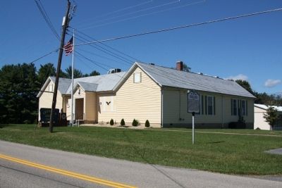
Photographed by J. J. Prats, September 23, 2012
3. Augusta County Training School Building
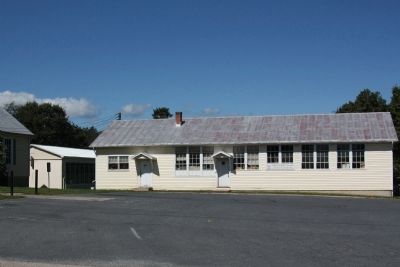
Photographed by J. J. Prats, September 23, 2012
4. Other Augusta County Training School Buildings
Credits. This page was last revised on April 10, 2021. It was originally submitted on September 23, 2012, by J. J. Prats of Powell, Ohio. This page has been viewed 1,383 times since then and 61 times this year. Photos: 1, 2, 3, 4. submitted on September 23, 2012, by J. J. Prats of Powell, Ohio.
