Alabaster in Shelby County, Alabama — The American South (East South Central)
The Founding of Alabaster
⎯⎯⎯
Siluria
Photographed by David J Gaines, September 19, 2012
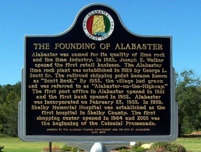
1. The Founding of Alabaster side of the marker
Alabaster was named for its quality of lime rock and the lime industry. In 1925, Joseph E. Walker opened the first retail business. The Alabaster lime rock plant was established in 1929 by George L. Scott Sr. The railroad shipping point became known as “Scott Rock.” By 1933, the village had grown and was referred to as “Alabaster-on the-Highway.” The first post office in Alabaster opened in 1951 and the first bank opened in 1952. Alabaster was incorporated on February 23, 1953. In 1959, Shelby Memorial Hospital was established as the first hospital in Shelby County. The first shopping center opened in 1964 and 2005 was the beginning of the Colonial Promenade.
(Back):
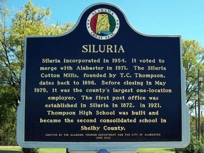
Siluria incorporated in 1954. It voted to merge with Alabaster in1971. The Siluria Cotton Mills, founded by T.C. Thompson, dates back to 1896. Before closing in May 1979, it was the county’s largest one-location employer. The first post office was established in Siluria in 1872. In 1921,Thompson High School was built and became the second consolidated school in Shelby County.
Erected 2010 by Alabama Tourism Department
this page online
Topics and series. This historical marker is listed in this topic list: Settlements & Settlers. In addition, it is included in the Alabama Tourism Department, and the Postal Mail and Philately series lists. A significant historical month for this entry is February 1867.
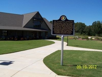
Location. 33° 13.922′ N, 86° 49.568′ W. Marker is in Alabaster, Alabama, in Shelby County. It is on 11th Street SW, on the right when traveling south. The marker is located in front of the Alabaster Senior Center. Touch for map. Marker is in this post office area: Alabaster AL 35007, United States of America. Touch for directions.

Regionally, this marker is in the Birmingham Metropolitan Area. It is also in the American South and specifically in the Deep South. Globally, it is in North America, a Gulf of Mexico state, the Western Hemisphere, the Western World, and the Anglosphere. Historically, it finds itself in what was once New Spain, the territory of the Mississippian Culture, one of the Confederate States of America, and the Antebellum South.
Other nearby markers. At least 8 other markers are within 5 miles of this marker, measured
Photographed by David J Gaines, September 19, 2012
2. Siluria side of the marker
Another marker is no longer nearby. Shelbyville, A. T. (was approx. 3.9 miles away but has been confirmed missing).
Photographed by David J Gaines, September 19, 2012
3. The Founding of Alabaster/Siluria Marker in front of the Senior Center
Credits. This page was last revised on June 16, 2016. It was originally submitted on September 23, 2012, by David J Gaines of Pinson, Alabama. This page has been viewed 1,543 times since then and 82 times this year. Photos: 1, 2, 3. submitted on September 23, 2012, by David J Gaines of Pinson, Alabama. • Craig Swain was the editor who published this page.
