Fountain Valley in Orange County, California — The American West (Pacific Coastal)
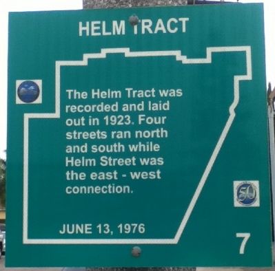
Helm Tract
Photographed by Greg Ullman, September 12, 2012
1. Helm Tract Marker
Erected by Fountain Valley Historical Society. (Marker Number 7.)
Topics. This historical marker is listed in this topic list: Settlements & Settlers. A significant historical year for this entry is 1923.
Location. 33° 42.069′ N, 117° 58.207′ W. Marker is in Fountain Valley, California, in Orange County. It is at the intersection of South Third Street and Talbert Avenue, on the right when traveling south on South Third Street. Touch for map. Marker is in this post office area: Fountain Valley CA 92708, United States of America. Touch for directions.

Regionally, this marker is in Greater Los Angeles and in the Peninsular Ranges. It is also on the American Pacific Coast. Globally, it is in North America, on the Ring of Fire, on the Pacific Rim, in the Western Hemisphere, in the Western World, and in the Anglosphere. Historically, it finds itself in what was once New Spain and also Mexico’s Alta California.
Other nearby markers. At least 8 other markers are within walking distance
this page online
Photographed by Greg Ullman, September 24, 2012
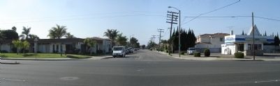
2. Panorama of Talbert Ave. and S. Third St.
Sam Talbert laid out 60 acres of streets here; his home was on the southeast corner, on the left. The historical marker is on the corner on the right.
Credits. This page was last revised on June 16, 2016. It was originally submitted on September 24, 2012, by Greg Ullman of Fountain Valley, California. This page has been viewed 810 times since then and 40 times this year. Photos: 1, 2. submitted on September 24, 2012, by Greg Ullman of Fountain Valley, California. • Syd Whittle was the editor who published this page.
