Fountain Valley in Orange County, California — The American West (Pacific Coastal)
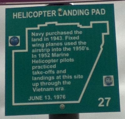
Helicopter Landing Pad
Erected 1976 by Fountain Valley Historical Society. (Marker Number 27.)
Topics. This historical marker is listed in these topic lists: Air & Space • Military • War, Vietnam • War, World II. A significant historical year for this entry is 1943.
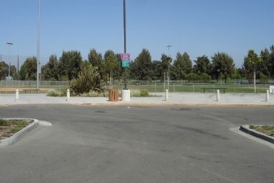
Location. 33° 43.574′ N, 117° 56.895′ W. Marker is in Fountain Valley, California, in Orange County. Marker can be reached from Brookhurst Street near Heil Avenue, on the right. Marker is located within Fountain Valley Recreation Center and Sports Park, at the northeast end of the parking lot near Ballfield #4. Touch for map. Marker is at or near this postal address: 16400 Brookhurst Street, Fountain Valley CA 92708, United States of America. Touch for directions.
Other nearby markers. At least 8 other markers are within 2 miles of this marker, measured as the crow flies. Colonia Jaurez (approx. 0.8 miles away); Post Brother's Plow (approx. 1.1 miles away); Hoffman House (approx. 1.2 miles away); Rancho Lucero (approx. 1.3 miles away); Thomas Hittesdorf (approx. 1.3 miles away); Horse Ranch (approx. 1.3 miles away); Ishii Home (approx. 1.4 miles away); Nimocks Home (approx. 1.7 miles away). Touch for a list and map of all markers in Fountain Valley.
Credits. This page was last revised on June 16, 2016. It was originally submitted on September 25, 2012, by Greg Ullman of Fountain Valley, California. This page has been viewed 1,085 times since then and 30 times this year. Photos: 1, 2. submitted on September 25, 2012, by Greg Ullman of Fountain Valley, California. • Syd Whittle was the editor who published this page.

