
Sainte-Mère-Église in Manche, Normandy, France — Western Europe
House on Fire at Sainte-Mère-Église
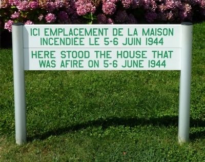
Photographed by Roger W. Sinnott, August 18, 2012
1. House on Fire at Sainte-Mère-Église Marker

incendiée le 5–6 juin 1944
—
was afire on 5–6 June 1944
Topics. This historical marker is listed in this topic list: War, World II. A significant historical date for this entry is June 6, 1944.
Location. 49° 24.509′ N, 1° 18.895′ W. Marker is in Sainte-Mère-Église, Normandie (Normandy), in Manche. It can be reached from rue Eisenhower. Marker is not visible from the road but is on the grounds of the Airborne Museum. Touch for map. Marker is at or near this postal address: 14 rue Eisenhower, Sainte-Mère-Église, Normandie 50480, France. Touch for directions.

Regionally, it is in the North Atlantic Region, Europe, the European Union, Atlantic Europe, the Schengen Area, Western Europe, a coastal Mediterranean country, and the Western World. Historically, it finds itself in what was once a French colony and also the Roman Empire.
Other nearby markers. At least 8 other markers are within walking distance of this marker: Truck Cargo 6×6 CCKW 353 (a few steps from this marker); M4A4 Sherman (within shouting distance of this marker); A Tous Les Français / To all French People
this page online
Regarding House on Fire at Sainte-Mère-Église. When paratroopers of the U.S. 82nd and 101st Airborne Divisions arrived over Sainte-Mère-Église between midnight and 2 a.m. on D-Day, June 6, 1944, many of the C-47 pilots were guided in their approach by the light from a house on fire. (In fact, the fire may have been accidentally set when illumination flares were dropped by the first planes over the town.)
In any event, the fire-fighting commotion meant that many townsfolk, as well as occupying German soldiers, were awake and outdoors night — and stunned to see the night sky filling up with parachutes.
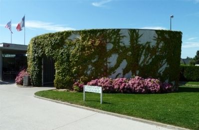
Photographed by Roger W. Sinnott, August 18, 2012
2. Marker on the Museum Grounds
The modern structure in the background contains the Airborne Museum’s restrooms.
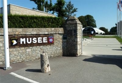
Photographed by Roger W. Sinnott, August 18, 2012
3. Entrance of the Airborne Museum
Credits. This page was last revised on April 20, 2021. It was originally submitted on September 25, 2012, by Roger W. Sinnott of Norwell, Massachusetts. This page has been viewed 1,140 times since then and 55 times this year. Photos: 1, 2, 3. submitted on September 25, 2012, by Roger W. Sinnott of Norwell, Massachusetts. • Bill Pfingsten was the editor who published this page.
