Keene in Cheshire County, New Hampshire — The American Northeast (New England)
The Old Fort
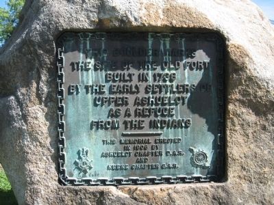
the site of the old fort
built in 1738
by the early settlers
of Upper Ashuelot
as a refuge
from the Indians
Erected 1906 by Ashuelot Chapter D.A.R. and Keene Chapter S.A.R.
Topics and series. This historical marker is listed in these topic lists: Colonial Era • Forts and Castles • Settlements & Settlers • War, US Revolutionary. In addition, it is included in the Daughters of the American Revolution, and the Sons of the American Revolution (SAR) series lists. A significant historical year for this entry is 1738.
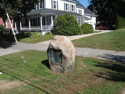
Location. 42° 55.577′ N, 72° 16.626′ W. Marker is in Keene, New Hampshire, in Cheshire County. Marker is on Main Street (New Hampshire Route 12) north of Gates Street, on the right when traveling north. Touch for map. Marker is at or near this postal address: 289 Main Street, Keene NH 03431, United States of America. Touch for directions.
Other nearby markers. At least 8 other markers are within walking distance of this marker. Dr. Daniel Adams House (about 300 feet away, measured in a direct line); Nathan Blake (approx. 0.2 miles away); The Old Road to Boston (approx. 0.2 miles away); The First Meeting House in Upper Ashuelot (approx. ¼ mile away); The Railroad (approx. 0.4 miles away); Magical History Tour (approx. 0.4 miles away); Industrial Heritage Trail (approx. 0.4 miles away); Barry Faulkner, Muralist (approx. half a mile away). Touch for a list and map of all markers in Keene.
Credits. This page was last revised on November 27, 2020. It was originally submitted on September 25, 2012, by Tony Farrick of Shelburne Falls, Ma.. This page has been viewed 793 times since then and 34 times this year. Photos: 1, 2. submitted on September 25, 2012, by Tony Farrick of Shelburne Falls, Ma.. • Bill Pfingsten was the editor who published this page.

