Central Oklahoma City in Oklahoma County, Oklahoma — The American South (West South Central)
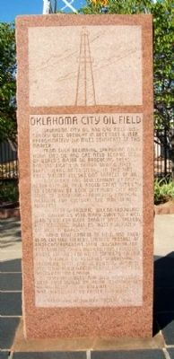
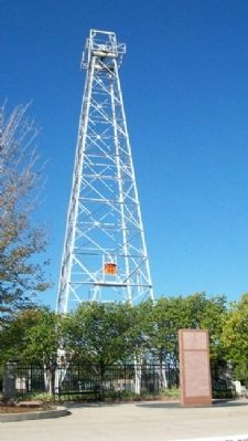
Oklahoma City Oil Field
Oklahoma City Oil and Gas Field Discovery Well brought in December 4, 1928, approximately six miles southeast of this marker.
From such beginning, sprawling Oklahoma City Oil and Gas Field became one of world's major oil producing areas, ranking eighth in nation during first forty years of existence. In this time Field yielded 733,543,000 barrels of oil.
Discovery and development of Oklahoma City Oil Field added great stability to economy of both Oklahoma City and State of Oklahoma -- providing financial incentive for cultural and industrial progress.
In tapping prolific Wilcox Producing Zone March 25, 1930, Mary Sudik No. 1 Well blew "wild" for more than 11 days thereby distinguishing itself as "most publicized oil well in world."
Rapid development of field, and problems created thereby, sparked passage of first comprehensive state legislation for conservation of oil and gas, thus providing model statutes for other states to follow.
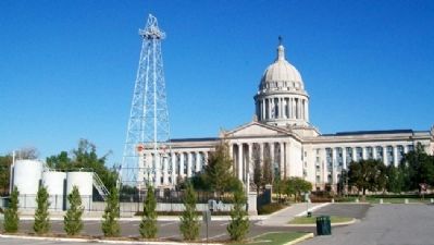
To reach oil reserves underlying Oklahoma State Capitol building, one well was slant-drilled from across street to oil sands beneath Capitol.
Discovery Well and "Wild Mary Sudik" were both drilled by Indian Territory Illuminating Oil Co., an affiliate of Cities Service Oil Co., and by Foster Petroleum Co.
Erected 1968 by Oklahoma Historical Society.
Topics and series. This historical marker is listed in these topic lists: Environment • Exploration • Industry & Commerce • Natural Resources. In addition, it is included in the Oklahoma Historical Society series list. A significant historical month for this entry is March 1850.
Location. 35° 29.458′ N, 97° 30.181′ W. Marker is in Oklahoma City, Oklahoma, in Oklahoma County. It is in Central Oklahoma City. Marker is at the intersection of Lincoln Boulevard and NE 21st Street, on the left when traveling north on Lincoln Boulevard. Marker is on the grounds of the Oklahoma State Capitol. Touch for map. Marker is at or near this postal address: 2300 North Lincoln Boulevard, Oklahoma City OK 73105, United States of America. Touch for directions.
Other nearby markers. At least 8 other markers are within walking distance of this marker. A Past to Remember, A Future to Mold (within shouting distance of this marker); As Long As The Waters Flow (within shouting distance of this marker); Oklahoma State Seal (within shouting distance of this marker); Oklahoma Timeline (within shouting distance of this marker); Tribute to Range Riders (within shouting distance of this marker); Flags Flown Over Oklahoma (within shouting distance of this marker); a different marker also named Oklahoma City Oil Field (within shouting distance of this marker); George Washington Elm Tree (within shouting distance of this marker). Touch for a list and map of all markers in Oklahoma City.
Also see . . . Milestones in the Oklahoma Oil and Gas Industry. (Submitted on October 1, 2012, by William Fischer, Jr. of Scranton, Pennsylvania.)
Credits. This page was last revised on March 25, 2024. It was originally submitted on September 30, 2012, by William Fischer, Jr. of Scranton, Pennsylvania. This page has been viewed 806 times since then and 34 times this year. Photos: 1, 2, 3. submitted on October 1, 2012, by William Fischer, Jr. of Scranton, Pennsylvania.


