Ballajá in San Juan in Municipio de San Juan, Puerto Rico — The Caribbean (The West Indies)
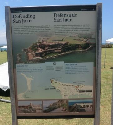
Defending San Juan
⎯⎯⎯
Defensa de San Juan
Photographed by Don Morfe, April 21, 2012
1. Defending San Juan Marker
More to See
Discover Castillo San Cristobal, the city wall, and Fort San Juan de la Cruz. Walk on the Paseo del Morro along San Juan Bay beneath San Felipe del Morro’s towering walls.
Español:
Defensa de San Juan
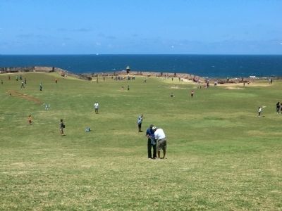
El Castillo de San Felipe de Morro, la fortaleza que está ubicada en el amplio campo frente a usted, protegía la Bahía de San Juan. Este forma parte del extenso sistema de fortificaciones construido por España durante un periodo de 250 años. La gran mayoría de estas fortificaciones - que usted puede visitar hoy día - componen el San Juan National Historic Site.
Más para ver
Descubra el Castillo San Cristóbal, las murallas de la ciudad y el Fortín San Juan de la Cruz. Camine por el Paseo del Morro localizado a lo largo de la Bahía de San Juan, al pie de las murallas de San Felipe del Morro.
Topics.
this page online
Location. Marker has been permanently removed. It was located near 18° 28.092′ N, 66° 7.266′ W. Marker was in San Juan in Municipio de San Juan, Puerto Rico. It was in Ballajá. It was on Calle Del Morro. Touch for map. Marker was in this post office area: San Juan PR 00926, United States of America.
We have been informed that this marker is no longer there and will not be replaced. This page is an archival view of what was.
Regionally, it was in one of the Greater Antilles on the Caribbean Sea, on in the Atlantic Ocean, in North America, in the Western Hemisphere, in the Western World, and in the Anglosphere. Historically, it found itself in what was once a Spanish colony.

Other nearby markers. At least 8 other markers are within walking distance of this location: Kites (within shouting distance of this marker); Plaza del Cuartel (about 300 feet away, measured in a direct line); The Dutch Attack of 1625 (about 500 feet away); Juan Ponce de Leon (approx. 0.3 kilometers away); La Rogativa (approx. 0.3 kilometers
Photographed by Don Morfe, April 21, 2012
2. Defending San Juan Marker
Photographed by Don Morfe, April 21, 2012
3. Defending San Juan Marker
Photographed by Don Morfe, April 21, 2012
4. Defending San Juan Marker
Credits. This page was last revised on March 28, 2026. It was originally submitted on October 6, 2012, by Don Morfe of Baltimore, Maryland. This page has been viewed 719 times since then and 40 times this year. Photos: 1, 2, 3, 4. submitted on October 6, 2012, by Don Morfe of Baltimore, Maryland. • Bill Pfingsten was the editor who published this page.
