Seymour in Webster County, Missouri — The American Midwest (Upper Plains)
Veterans
⎯⎯⎯
Pioneers Memorial
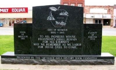
State of Missouri 1821 • County of Webster 1855 • City of Seymour 1895-1995
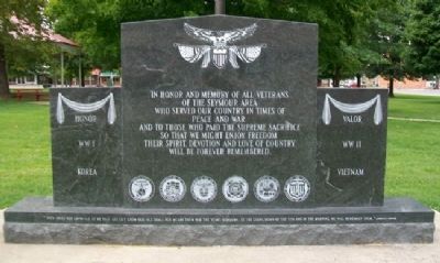
| — | Honor • WWI • WWII • Korea • Vietnam • Valor | — |
Photographed by William Fischer, Jr., August 12, 2012
1. Veterans Memorial (Side A)
In honor and memory of all veterans of the Seymour area who served our country in times of peace and war and to those who paid the supreme sacrifice so that we might enjoy freedom Their spirit, devotion and love of country will be forever remembered.
"They shall not grow old as we that are left grow old. Age shall not weary them nor the years condemn. At the going down of the Sun and in the morning we will remember them."
Lawrence Newton
To all Pioneers whose footprints shall remain for all eternity…
May we remember as we labor for those still to come.
Erected 1995 by Seymour Area History Book Club.
Topics. This memorial is listed in this topic list: Military.
Location. 37° 8.81′ N, 92° 46.105′ W. Memorial is in Seymour, Missouri, in Webster County. It is on Main Street south of Market Street, on the right when traveling south. Memorial is on the town square. Touch for map. Memorial is in this post office area: Seymour MO 65746, United States of America. Touch for directions.

Regionally, this memorial is in Southwest Missouri and in Greater Springfield.
this page online
Other nearby markers. At least 8 other markers are within 15 miles of this marker, measured as the crow flies: Veterans Memorial (approx. 10.4 miles away); War Memorial (approx. 10.6 miles away); Laura Ingalls Wilder (approx. 10.7 miles away); Carl "Sub" Mays (approx. 10.7 miles away); Rocky Ridge Farm (approx. 11.7 miles away); Wilder's Pecan Tree (approx. 11.7 miles away); Douglas County Veterans Memorial (approx. 13.9 miles away); Douglas County (approx. 14.8 miles away).
Photographed by William Fischer, Jr., August 12, 2012
2. Pioneers Memorial (Side B)
Photographed by William Fischer, Jr., August 12, 2012
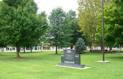
3. Veterans / Pioneers Memorial
Credits. This page was last revised on October 6, 2020. It was originally submitted on October 6, 2012, by William Fischer, Jr. of Reynoldsburg, Ohio. This page has been viewed 487 times since then and 16 times this year. Photos: 1, 2, 3. submitted on October 6, 2012, by William Fischer, Jr. of Reynoldsburg, Ohio.
