Les Remparts
[The Ramparts]
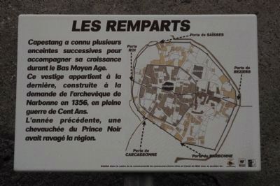
[Translation by Google Translate (with modifications):
The Ramparts
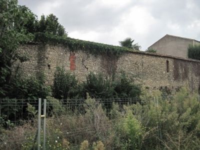
Capestang has experienced several successive enclosures for accommodate growth during the late Middle Ages. This wall belongs to the last vestige, built at the request of the Archbishop of Narbonne in 1356, in the midst Hundred Years War. The previous year, a raid by the Black Prince had devastated the region.]
Topics. This historical marker is listed in this topic list: Notable Places. A significant historical year for this entry is 1356.
Location. 43° 19.627′ N, 3° 2.567′ E. Marker is in Capestang, Occitanie (Occitania), in Hérault. It is at the intersection of Rue Carnot and Rue Victor Hugo on Rue Carnot. Touch for map. Marker is at or near this postal address: 21 Rue Carnot, Capestang, Occitanie 34310, France. Touch for directions.
Regionally,
this page online
Other nearby markers. At least 8 other markers are within walking distance of this marker: Le Domaine CASTRES (about 90 meters away, measured in a direct line); La maison Lignon (about 120 meters away); La collégiale Saint Etienne (about 150 meters away); Rafle Du 9 Juin 1944 (about 150 meters away); La maison romane (about 150 meters away); Le Bassin Rond (about 180 meters away); Le Château de l’archevêque (approx. 0.2 kilometers away); La fontaine du Théron (approx. 0.3 kilometers away). Touch for a list and map of all markers in Capestang.

Credits. This page was last revised on September 10, 2018. It was originally submitted on October 7, 2012, by Barry Swackhamer of Brentwood, California. This page has been viewed 536 times since then and 28 times this year. Photos: 1, 2, 3, 4. submitted on October 7, 2012, by Barry Swackhamer of Brentwood, California. • Bill Pfingsten was the editor who published this page.
