Capestang in Hérault, Occitania, France — Western Europe
Porte de Béziers
[The Bezier Gate]
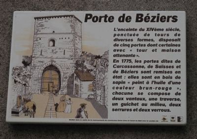
Photographed by Barry Swackhamer, September 18, 2012
1. Porte de Béziers Marker
Topics. This historical marker is listed in these topic lists: Forts and Castles • Notable Buildings. A significant historical year for this entry is 1775.
Location. 43° 19.647′ N, 3° 2.838′ E. Marker is in Capestang, Occitanie (Occitania), in Hérault. It is on Boulevard Pasteur.
this page online

Regionally, it is in the North Atlantic Region, Europe, the European Union, Atlantic Europe, the Schengen Area, Western Europe, a coastal Mediterranean country, and the Western World. Historically, it finds itself in what was once a French colony and also the Roman Empire.
Other nearby markers. At least 8 other markers are within walking distance of this marker: L’Hôpital (within shouting distance of this marker); Le Château de l’archevêque (about 210 meters away, measured in a direct line); La maison vigneronne (about 210 meters away); Le Bassin Rond (about 210 meters away); Rafle Du 9 Juin 1944 (approx. 0.3 kilometers away); La fontaine du Théron (approx. 0.3 kilometers away); Le Domaine CASTRES (approx. 0.3 kilometers away); La collégiale Saint Etienne (approx. 0.3 kilometers away). Touch for a list and map of all markers in Capestang.
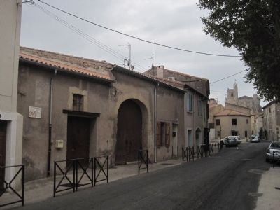
Photographed by Barry Swackhamer, September 18, 2012
2. Porte de Béziers Marker
Credits. This page was last revised on September 10, 2018. It was originally submitted on October 7, 2012, by Barry Swackhamer of Brentwood, California. This page has been viewed 496 times since then and 10 times this year. Photos: 1, 2. submitted on October 7, 2012, by Barry Swackhamer of Brentwood, California. • Bill Pfingsten was the editor who published this page.
