Philipsburg in Centre County, Pennsylvania — The American Northeast (Mid-Atlantic)
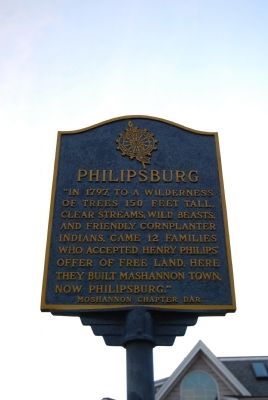
Philipsburg
Photographed by Mike Wintermantel, October 6, 2012
1. Philipsburg Marker
Erected by Moshannon Chapter Daughters of the American Revolution.
Topics and series. This historical marker is listed in these topic lists: Indigenous Peoples and Communities • Settlements & Settlers. In addition, it is included in the Daughters of the American Revolution (DAR) series list. A significant historical year for this entry is 1797.
Location. 40° 53.793′ N, 78° 13.242′ W. Marker is in Philipsburg, Pennsylvania, in Centre County. It is at the intersection of North 3rd Street and East Presqueisle Street (Pennsylvania Route 53), on the left when traveling south on North 3rd Street. Located at the Philipsburg Town Hall. Touch for map. Marker is in this post office area: Philipsburg PA 16866, United States of America. Touch for directions.

Regionally, this marker is in the Pennsylvania Wilds. It is also in the American Northeast, in the Mid-Atlantic, in Appalachia, and specifically in Northern Appalachia. Globally, it is in North America, the Western Hemisphere, the Western World, and the Anglosphere. Historically, it finds itself in what was once the Haudenosaunee (Iroquois) Confederacy and also one of the original Thirteen Colonies.
Other nearby markers. At least 8 other markers are within 7 miles of this marker, measured as the crow flies: John Henry Simler House (about 300 feet away, measured in a direct line); Halehurst (approx. 0.2 miles away); Union Church (approx. 0.2 miles away); Kyler Homestead (approx. 2.2 miles away); Indian Paths (approx. 2.4 miles away); Osceola Mills (approx. 4 miles away); Site of Wolf Rocks Camp (approx. 6.1 miles away); Plumbe Forge
this page online
Photographed by Mike Wintermantel, October 6, 2012
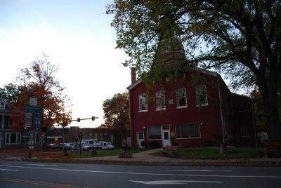
2. Philipsburg Marker
At Philipsburg Town Hall
Photographed by Mike Wintermantel, October 6, 2012
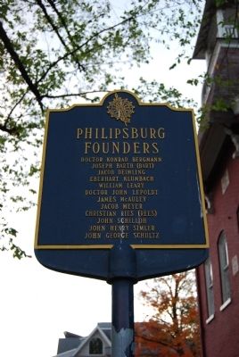
3. Philipsburg Founders Sign
Joseph Barth (Bart)
Jacob Deimling
Eberhart Klumbach
William Leary
Doctor John Lepoldt
James McAuley
Jacob Meyer
Christian Ries (Rees)
John Schilloh
John Henry Simler
John George Schultz
Credits. This page was last revised on June 16, 2016. It was originally submitted on October 7, 2012, by Mike Wintermantel of Pittsburgh, Pennsylvania. This page has been viewed 1,117 times since then and 70 times this year. Photos: 1, 2, 3. submitted on October 7, 2012, by Mike Wintermantel of Pittsburgh, Pennsylvania.
