Goodyears Bar in Sierra County, California — The American West (Pacific Coastal)
Goodyears Bar Schoolhouse
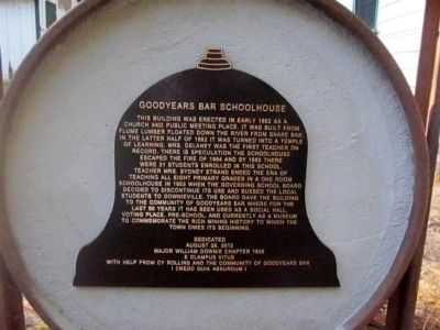
Photographed by Syd Whittle, October 14, 2012
1. Goodyears Bar Schoolhouse Marker
Erected 2012 by Major William Downie Chapter 1849, E Clampus Vitus, Cy Rollins and the Community of Goodyears Bar.
Topics and series. This historical marker is listed in these topic lists: Education • Settlements & Settlers. In addition, it is included in the E Clampus Vitus
this page online
Location. 39° 32.444′ N, 120° 53.066′ W. Marker is in Goodyears Bar, California, in Sierra County. It is on Old Toll Bridge Road east of Mountain House Road, on the left when traveling east. Touch for map. Marker is at or near this postal address: 500 Old Toll Bridge Road, Goodyears Bar CA 95944, United States of America. Touch for directions.

Regionally, this marker is in the Sierra Nevada. It is also in the American Mountain West. Globally, it is in North America, on the Ring of Fire, on the Pacific Rim, in the Western Hemisphere, in the Western World, and in the Anglosphere. Historically, it finds itself in what was once New Spain and also Mexico’s Alta California.
Other nearby markers. At least 8 other markers are within 4 miles of this marker, measured as the crow flies: Goodyears Bar (about 500 feet away, measured in a direct line); The St. Charles Hotel (approx. 0.2 miles away); Rite Here (approx. 2.8 miles away); Mountain House (approx. 2.8 miles away); Cannon Point - California Volunteers Memorial (approx. 3 miles away); Downieville (approx. 3 miles away);
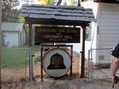
Photographed by Syd Whittle, October 14, 2012
2. Goodyears Bar Schoolhouse Marker
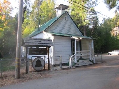
Photographed by Syd Whittle, October 14, 2012
3. Goodyears Bar Schoolhouse and Marker
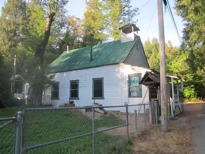
Photographed by Syd Whittle, October 14, 2012
4. Goodyears Bar Schoolhouse
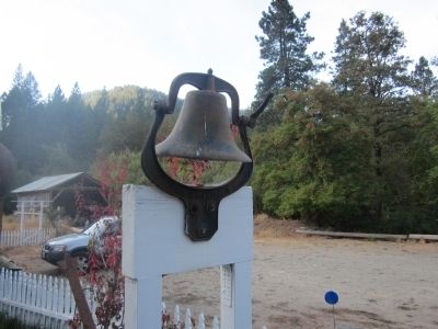
Photographed by Syd Whittle, October 14, 2012
5. Goodyears Bar Schoolhouse Bell
It is believed that this bell, located at the nearby Helm's St. Charles Inn Bed and Breakfast, is the original schoolhouse bell.
Credits. This page was last revised on August 29, 2020. It was originally submitted on October 15, 2012, by Syd Whittle of Mesa, Arizona. This page has been viewed 602 times since then and 31 times this year. Photos: 1, 2, 3, 4, 5. submitted on October 15, 2012, by Syd Whittle of Mesa, Arizona.
