South Fork in Cambria County, Pennsylvania — The American Northeast (Mid-Atlantic)
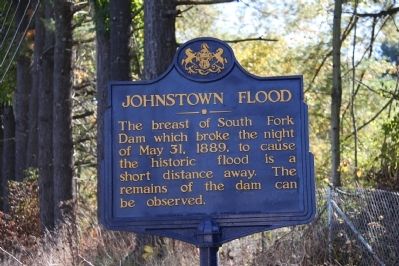
Johnstown Flood
Erected 1947 by Pennsylvania Historical and Museum Commission.
Topics and series. This historical marker is listed in this topic list: Disasters. In addition, it is included in the Pennsylvania Historical and Museum Commission series list. A significant historical date for this entry is May 31, 1995.
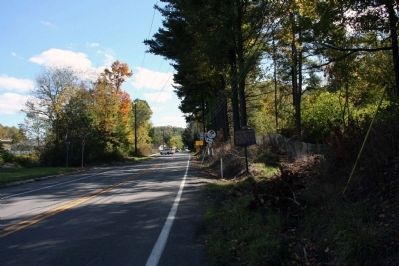
Location. 40° 20.822′ N, 78° 47.037′ W. Marker is in South Fork, Pennsylvania, in Cambria County. Marker is at the intersection of Ragers Hill Road and Locust Street on Ragers Hill Road. Touch for map. Marker is in this post office area: South Fork PA 15956, United States of America. Touch for directions.
Other nearby markers. At least 8 other markers are within 4 miles of this marker, measured as the crow flies. The South Fork Dam (approx. half a mile away); The Dam Melts Away (approx. 0.7 miles away); Lake Conemaugh (approx. 0.7 miles away); The Unger House (approx. 0.7 miles away); May 31, 1889 (approx. 0.7 miles away); American Legion Post 551 Veterans Memorial (approx. 0.9 miles away); Saint Michael World War II Honor Roll (approx. 1˝ miles away); Allegheny Portage Railroad (approx. 3.4 miles away).
Related markers. Click here for a list of markers that are related to this marker. To better understand the relationship, study each marker in the order shown.
Also see . . .
1. Johnstown Flood National Memorial. (Submitted on October 18, 2012, by Byron Hooks of Sandy Springs, Georgia.)
2. Johnstown Flood. Wikipedia (Submitted on October 18, 2012, by Byron Hooks of Sandy Springs, Georgia.)
Credits. This page was last revised on June 16, 2016. It was originally submitted on October 18, 2012, by Byron Hooks of Sandy Springs, Georgia. This page has been viewed 867 times since then and 10 times this year. Photos: 1, 2, 3. submitted on October 18, 2012, by Byron Hooks of Sandy Springs, Georgia. • Bill Pfingsten was the editor who published this page.


