Urban Core in Jacksonville in Duval County, Florida — The American South (South Atlantic)
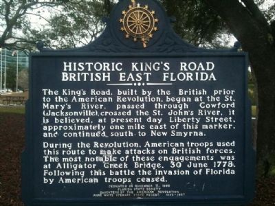
Historic King's Road British East Florida
Photographed by MacGeorge Johnson
1. Historic King's Road British East Florida Marker
During the Revolution, American troops used this route to make attacks on British forces. The most notable of these engagements was at Alligator Creek Bridge, 30 June 1778. Following this battle the invasion of Florida by American troops ceased.
Erected 1996 by Florida State Society - Daughters of the American Revolution - Anne White Stewart, State Regent 1995-1997.
Topics and series. This historical marker is listed in this topic list: Roads & Vehicles. In addition, it is included in the Daughters of the American Revolution (DAR) series list. A significant historical date for this entry is June 30, 1778.
Location. 30° 19.208′ N, 81° 39.629′ W. Marker is in Jacksonville, Florida, in Duval County. It is in Urban Core. It is on Museum Circle. Located by Friendship Fountain in Jacksonville, just off San Marco Blvd. Touch for map. Marker
this page online

Regionally, this marker is in First Coast. It is also in the American South and on the Eastern Seaboard. Globally, it is in the North Atlantic Region, North America, a Gulf of Mexico state, the Western Hemisphere, the Western World, and the Anglosphere. Historically, it finds itself in what was once New Spain, the territory of the Mississippian Culture, one of the Confederate States of America, and the Antebellum South.
Other nearby markers. At least 8 other markers are within walking distance of this marker: Soldiers of the American Revolution Associated with Jacksonville’s History (approx. ¼ mile away); Jacksonville's Favorite Oak (Quercus virginiana) (approx. ¼ mile away); Jessie Ball DuPont Park (approx. ¼ mile away); Treaty Oak Conservation Project Dedication (approx. 0.3 miles away); Sinking of the Maple Leaf (approx. 0.3 miles away); Andrew Jackson (approx. 0.4 miles away); Site of Cow Ford (approx. 0.4 miles away); Jacksonville National Bank - 1902 (approx. half a mile away). Touch for a list and map of all markers
Photographed by Paul Crumlish, May 21, 2006
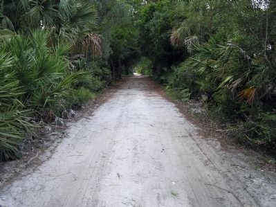
2. Section of King's Road
One of the last remaining unpaved or modernized stretches of the original King's Road. Located in northern Volusia County, it had been by-passed by a wider, straighter modern highway.
Other markers no longer nearby. The St. Johns (was a few steps from this marker but has been confirmed missing); The Beginning (was approx. half a mile away but has been permanently removed).
Photographed by Mike Stroud, July 15, 2012
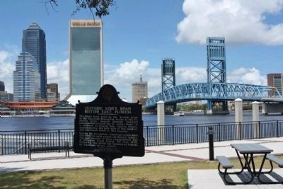
3. Historic King's Road British East Florida Marker
by Friendship Fountain along the St. Johns River, southbank
Photographed by Mike Stroud, July 15, 2012
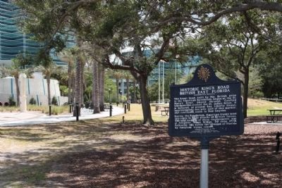
4. Historic King's Road British East Florida Marker, looking towards San Marco Boulevard
Credits. This page was last revised on February 3, 2023. It was originally submitted on November 23, 2011, by Shane Cormier of Lafayette, Louisiana. This page has been viewed 2,008 times since then and 75 times this year. Last updated on October 19, 2012, by Ray King of Jacksonville, Florida. Photos: 1. submitted on November 23, 2011, by Shane Cormier of Lafayette, Louisiana. 2. submitted on March 7, 2012, by PaulwC3 of Northern, Virginia. 3, 4. submitted on July 16, 2012, by Mike Stroud of Bluffton, South Carolina. • Bill Pfingsten was the editor who published this page.
