
West Pocomoke in Somerset County, Maryland — The American Northeast (Mid-Atlantic)
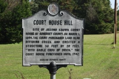
Court House Hill
Photographed by Mike Stroud, October 20, 2012
1. Court House Hill Marker
Erected by Maryland Historical Society.
Topics and series. This historical marker is listed in this topic list: Notable Places. In addition, it is included in the Maryland Historical Trust series list. A significant historical date for this entry is March 1, 1694.
Location. 38° 6.032′ N, 75° 33.165′ W. Marker is in West Pocomoke, Maryland, in Somerset County. It is at the intersection of Dividing Creek Road (Maryland Route 364) and Court House Hill Road, on the right when traveling south on Dividing Creek Road. Located 2.3 miles northeast of US 13 (Ocean Highway). Touch for map. Marker is at or near this postal address: 8055 Dividing Creek Road, Pocomoke City MD 21851, United States of America. Touch for directions.

Regionally, this marker is on the Eastern Shore. It is also in the American Mid-Atlantic, on the Delmarva Peninsula, in the Tidewater, in the Chesapeake Bay Region, and on the Eastern
this page online
Other nearby markers. At least 8 other markers are within 2 miles of this marker, measured as the crow flies: Olive Marie Lippoldt (approx. 1.9 miles away); Loblolly Pine (approx. 1.9 miles away); River Trades & Traditions / River Lore & Legend (approx. 1.9 miles away); In Memory of the Deceased Who Served to Protect Our Country (approx. 1.9 miles away); Mar-Va Theater (approx. 1.9 miles away); Sturgis One-Room School Museum (approx. 2 miles away); The Shapes of Ships (approx. 2 miles away); Costen House (approx. 2 miles away).
Another marker is no longer nearby. Sturgis One Room School (was approx. 2 miles away but has been replaced with another marker now near it).
Photographed by Mike Stroud, October 20, 2012
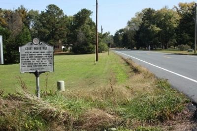
2. Court House Hill Marker, seen along Dividing Creek Road (Maryland Route 364)
Photographed by Mike Stroud, October 20, 2012
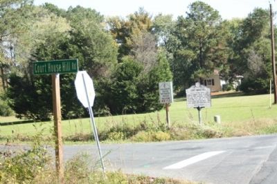
3. Marker at Court House Hill Road
Credits. This page was last revised on June 11, 2026. It was originally submitted on October 22, 2012, by Mike Stroud of Bluffton, South Carolina. This page has been viewed 884 times since then and 58 times this year. Photos: 1, 2, 3. submitted on October 23, 2012, by Mike Stroud of Bluffton, South Carolina.
