Redwood City in San Mateo County, California — The American West (Pacific Coastal)
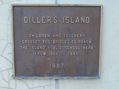
Diller's Island
crossed footbridges to reach
the "Island" public school here
from 1864 to 1895
Erected 1967.
Topics. This historical marker is listed in this topic list: Education. A significant historical year for this entry is 1864.
Location. 37° 29.042′ N, 122° 13.633′ W. Marker is in Redwood City, California, in San Mateo County. Marker is on Middlefield Road, half a mile Woodside Road (California Route 84), on the left when traveling west. Touch for map. Marker is at or near this postal address: 1044 Middlefield Road, Redwood City CA 94063, United States of America. Touch for directions.
Other nearby markers. At least 8 other markers are within walking distance of this marker. Fire Station No. 1 (a few steps from this marker); a different marker also named Fire Station No. 1 (a few steps from this marker); Redwood City War Memorial (about 300 feet away, measured in a direct line); Stage Station (about 500 feet away); Alhambra Theater (about 800 feet away); Embarcadero Turning Basin Site (approx. 0.2 miles away); Eureka Corner (approx. 0.2 miles away); Sequoia Union High School (approx. 0.2 miles away). Touch for a list and map of all markers in Redwood City.
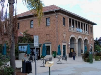
More about this marker. The marker is at the lower left corner of the old Fire Station No. 1 / Main Library building.
Credits. This page was last revised on February 1, 2021. It was originally submitted on October 23, 2012, by James King of San Miguel, California. This page has been viewed 522 times since then and 14 times this year. Photos: 1, 2. submitted on October 23, 2012, by James King of San Miguel, California. • Syd Whittle was the editor who published this page.

