Rockport in Aransas County, Texas — The American South (West South Central)
The Cedars
Photographed by Norman Frank, October 27, 2012
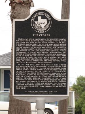
1. The Cedars Marker
In 1946 Miss Ethel Jones who lived in San Antonio purchased the property and hired an on-site manager. After retiring to the property in 1964, she sold the Cedars to her nephew, Charles Stevens, in 1971. Guests from Texas and out of state continued to visit the Cedars. In 1973, Stevens
this page online
Marker is property of the State of Texas
Erected 2012 by Texas Historical Commission. (Marker Number 16784.)
Topics and series. This historical marker is listed in this topic list: Landmarks. In addition, it is included in the Windmills series list. A significant historical year for this entry is 1928.
Location. 28° 0.686′ N, 97° 3.291′ W. Marker is in Rockport, Texas, in Aransas County. It is on Water Street 0.1 miles south of East King Street, on the right when traveling south. South Water Street is one-way going south. Touch for map. Marker is at or near this
Photographed by Norman Frank, October 27, 2012
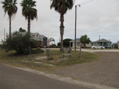
2. View of Sign and Marker with the Cedars in the background

Regionally, this marker is on the American Gulf Coast. Globally, it is in North America, a Gulf of Mexico state, the Western Hemisphere, the Western World, and the Anglosphere. Historically, it finds itself in what was once New Spain, the Republic of Texas, and one of the Confederate States of America.
Other nearby markers. At least 8 other markers are within walking distance of this marker: The Old Beach Road (approx. 0.3 miles away); The Hagar’s Rockport Cottages (approx. 0.3 miles away); Simon Michael Gallery (approx. 0.4 miles away); Hynes-Balthrope House (approx. half a mile away); Baylor-Norvell House (approx. half a mile away); Site of Heldenfels Shipyard (approx. 0.6 miles away); Mathis House (approx. 0.6 miles away); Shipyards in Rockport (approx. 0.6 miles away). Touch for a list and map of all markers in Rockport.
Additional keywords. Aransas County Historical Society
Photographed by Norman Frank, October 27, 2012
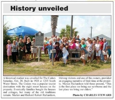
3. Cedars Marker Dedication in the 10/24/2012 Rockport Pilot
Sponsored by the Aransas County Historical Society
Credits. This page was last revised on June 16, 2016. It was originally submitted on October 27, 2012. This page has been viewed 1,613 times since then and 102 times this year. Photos: 1, 2, 3. submitted on October 27, 2012, by Norman Frank of Rockport, Texas. • Bernard Fisher was the editor who published this page.
