Sierra Blanca in Hudspeth County, Texas — The American South (West South Central)
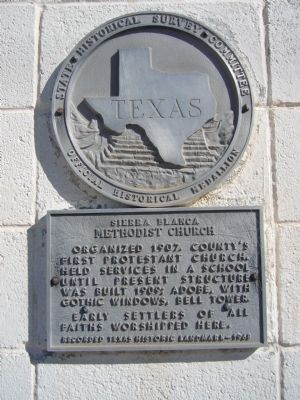
Sierra Blanca Methodist Church
Photographed by Bill Kirchner, October 21, 2012
1. Sierra Blanca Methodist Church Marker
Erected 1968 by State Historical Survey Committee. (Marker Number 4694.)
Topics. This historical marker is listed in this topic list: Religion & Religious Structures. A significant historical year for this entry is 1907.
Location. 31° 10.602′ N, 105° 21.395′ W. Marker is in Sierra Blanca, Texas, in Hudspeth County. It is on Sierra Blance Avenue (Ranch to Market Road 1111) 0.2 miles north of Interstate 10, on the right when traveling north. Touch for map. Marker is in this post office area: Sierra Blanca TX 79851, United States of America. Touch for directions.

Regionally, this marker is in the Trans-Pecos & Big Bend Region. It is also in the American Borderlands and in the Southwest. Globally, it is in North America, a Gulf of Mexico state, the Western Hemisphere, the Western World, and the Anglosphere. Historically, it finds itself in what was once New Spain, the Republic
this page online
Other nearby markers. At least 7 other markers are within 9 miles of this marker, measured as the crow flies: America's Second Transcontinental Railroad (approx. 0.2 miles away); Hudspeth County (approx. 0.2 miles away); The Killing of General J. J. Byrne (approx. 0.2 miles away); Fort Quitman (approx. 0.2 miles away); Hudspeth County Courthouse (approx. 0.2 miles away); August Fransal (approx. 0.4 miles away); Claude Hudspeth (approx. 8½ miles away).
Photographed by Bill Kirchner, October 21, 2012
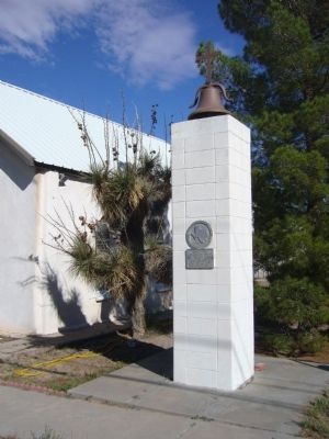
2. Sierra Blanca Methodist Church Marker
Photographed by Bill Kirchner, October 21, 2012
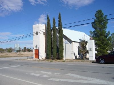
3. Sierra Blanca Methodist Church
Credits. This page was last revised on June 16, 2016. It was originally submitted on October 31, 2012, by Bill Kirchner of Tucson, Arizona. This page has been viewed 707 times since then and 43 times this year. Photos: 1, 2, 3. submitted on October 31, 2012, by Bill Kirchner of Tucson, Arizona. • Bernard Fisher was the editor who published this page.
