New Buffalo in Berrien County, Michigan — The American Midwest (Great Lakes)
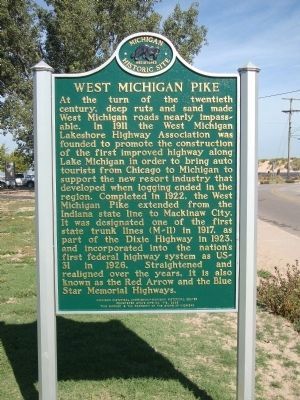
West Michigan Pike
At the turn of the twentieth century, deep ruts and sand made West Michigan roads nearly impassable. In 1911 the West Michigan Lakeshore Highway Association was founded to promote the construction of the first improved highway along Lake Michigan in order to bring auto tourists from Chicago to Michigan to support the new resort industry that developed when logging ended in the region. Completed in 1922, the West Michigan Pike extended from the Indiana state line to Mackinaw City. It was designated on of the first state trunk lines (M-11) in 1917, as part of the Dixie Highway in 1923, and incorporated into the nation's first federal highway system as US-31 in 1926. Straightened and realigned over the years, it is also known as the Red Arrow and the Blue Star Memorial Highways.
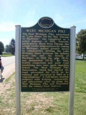
(side 2)
The West Michigan Pike, advertised as "Lake Shore All the Way Chicago to Mackinaw," was completed as a paved highway in 1922. Tourists, particularly those from Chicago who sought cooler temperatures by coming to Michigan, gained greater access to communities dotting the Lake Michigan shore between the Indiana state line and the Straits of Mackinac. In 1926 the pike (M-11), was designated US-31. By then, traffic congestion and poor road conditions were once again impeding travel. The West Michigan Pike Association, which had started the road, advocated for US-31 to be widened and rerouted in 1929 as a "superhighway." A full-blown tourism industry with lodging, restaurants, and attractions grew up along the West Michigan Pike and flourished into the twenty-first century.
Erected 2009 by Michigan Historical Commission-Michigan Historical Center. (Marker Number 718.)
Topics and series. This historical marker is listed in these topic lists: Industry & Commerce • Roads & Vehicles. In addition, it is included in the Michigan Historical Commission series list. A significant historical year for this entry is 1911.
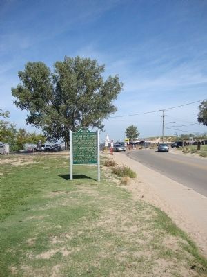
Location. 41° 47.973′ N, 86° 44.862′ W. Marker is in New Buffalo, Michigan, in Berrien County. Marker is on North Whittaker Street, 0.2 miles north of East Water Street, on the left when traveling north. Touch for map. Marker is in this post office area: New Buffalo MI 49117, United States of America. Touch for directions.
Other nearby markers. At least 8 other markers are within 3 miles of this marker, measured as the crow flies. Avoiding Removal - The Pokagon Band of Potawatomi (approx. 0.2 miles away); 9:03 a.m. September 11th 2001 (approx. 1.6 miles away); 8:46 a.m. September 11th 2001 (approx. 1.6 miles away); The 9-11 attacks resulted in the death of 2,996 people (approx. 1.6 miles away); New Buffalo Welcome Center (approx. 2.4 miles away); The Iron Brigade / The Twenty-Fourth Michigan Volunteer Infantry Regiment (approx. 2.4 miles away); Eisenhower Interstate System (approx. 2.4 miles away); Gordon Beach Inn (approx. 3.1 miles away). Touch for a list and map of all markers in New Buffalo.
Credits. This page was last revised on June 16, 2016. It was originally submitted on November 4, 2012. This page has been viewed 924 times since then and 33 times this year. Photos: 1, 2, 3, 4. submitted on November 4, 2012, by Mh of Las Vegas, Nevada. • Bernard Fisher was the editor who published this page.


